Plan your visit · Orientation
Laguna Beach map
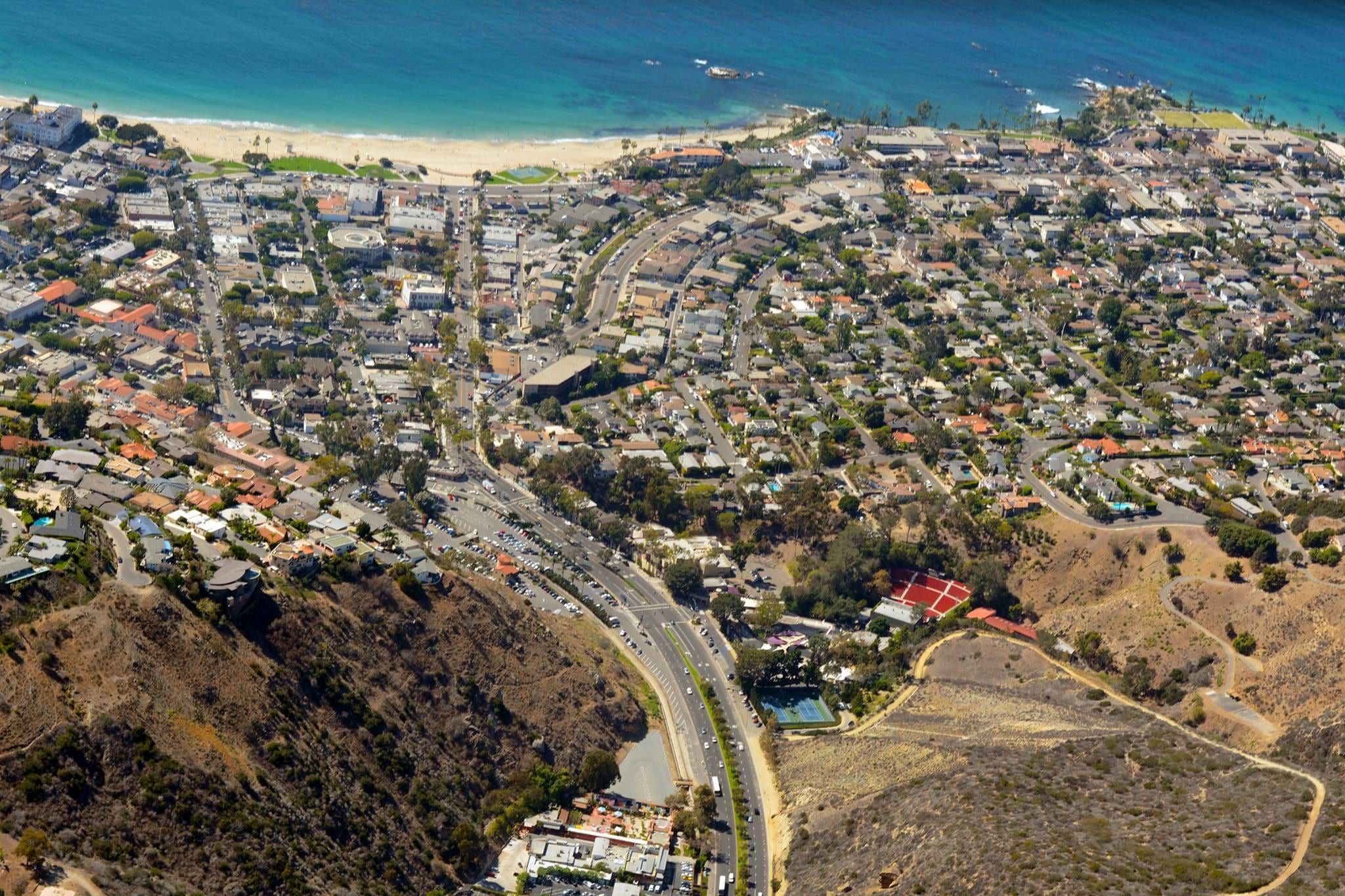
Laguna Beach runs along Coast Highway from North Laguna to South Laguna, with Laguna Canyon Road running inland from the Village. This guide says where the areas, beaches, parks, lots and trolley routes sit.
Photo: Don Ramey Logan, CC BY-SA 3.0

- Size
- 8.84 square miles, per the city
- Coast road
- Coast Highway, State Route 1
- Inland road
- Laguna Canyon Road, State Route 133
- Areas
- North Laguna to South Laguna, plus the canyon
- City maps
- GIS viewer, trolley and parking maps
Blue dots are beaches and coral pins are neighborhoods; each opens its page. The full list is on the beaches and neighborhoods pages.
How the town lays out
Laguna Beach is a coastal strip with a short canyon running inland. The city says it covers 8.84 square miles in southwest Orange County. Nearly everything a visitor wants sits along Coast Highway, which is Pacific Coast Highway, State Route 1.
The map above pins the beaches and the neighborhoods, and each pin opens its page. The sections below read the coast from north to south.
North to south
North of town. Crystal Cove State Park lies west of Coast Highway between Corona del Mar and Laguna Beach, per the California Coastal Commission. See Crystal Cove State Park.
North Laguna. The streets north of the Village follow North Coast Highway and Cliff Drive. Along Cliff Drive the Coastal Commission lists a run of access points: Crescent Bay at Circle Way, Shaw’s Cove, Fisherman’s Cove and Divers Cove, then Picnic Beach and Rockpile Beach beside Heisler Park. More in North Laguna and Heisler Park.
The Village. Downtown centers on Forest Avenue, Ocean Avenue and Glenneyre Street. Main Beach sits at the west end of Broadway Street, and the Laguna Art Museum is at 307 Cliff Drive. More in the Village.
The HIP District. South of the Village, South Coast Highway becomes a strip of galleries, shops, restaurants and hotels. The district’s merchant website places it on ten walkable streets from Thalia Street to Diamond Street; Visit Laguna Beach gives a shorter span, Anita Street to Bluebird Canyon. More in the HIP District.
Woods Cove. The cove lies west of Coast Highway between Pearl Street and Diamond Street, at the south end of the merchants’ HIP District span. More in Woods Cove and the Woods Cove beach page.
Victoria Beach. South of Woods Cove, the Coastal Commission places Victoria Beach south of Victoria Drive. More in the Victoria Beach neighborhood.
South Laguna. The south end of the city follows Coast Highway toward Dana Point. Treasure Island lies seaward of the Montage resort at Wesley Drive, and Aliso Beach sits in the 31000 block of South Coast Highway. Farther south, the Coastal Commission lists Thousand Steps Beach opposite 9th Avenue. More in South Laguna.
The canyon road inland
Laguna Canyon Road is State Route 133. Visit Laguna Beach says Highway 133 South turns into Laguna Canyon Road and becomes Broadway. Laguna Coast Wilderness Park lies on the west side of the road about three miles inland from Coast Highway, and the Pacific Marine Mammal Center is at 20612 Laguna Canyon Road. The Laguna Canyon page covers the corridor, and Laguna Coast Wilderness Park and Aliso and Wood Canyons cover the trails.
City parking lots on the map
The city lists its public lots with street addresses. Downtown, Lot 1 is at 234 Broadway Street, Lot 2 (Peppertree) at 322 Forest Avenue, Lot 5 (Mermaid) at 348 Glenneyre Street and Lot 15 (the Transit Depot) at 362 Ocean Avenue. On the canyon road, Lot 10 is at 725 Laguna Canyon Road and Lot 16 (Act V) at 1900 Laguna Canyon Road. In the south, Treasure Island has Lots 7 and 8 on Coast Highway, Lot 19 (Mission Hospital) is at 31872 Coast Highway, and Lot 22 serves Aliso Beach at 31131 Coast Highway.
Rates, hours and permits are in the parking guide. The city also posts a golf cart parking map on its lot page.
Trolley routes on the map
The city’s Coastal Route follows Coast Highway between North Laguna and Heisler Park, downtown, South Laguna and Mission Hospital, and the Ritz Carlton in Dana Point. In the off-season, which runs from September 8, 2026 to June 25, 2027, the Canyon Route runs from Lot 16 on Laguna Canyon Road to downtown on weekends. Hours and fares are on the trolley page.
The city’s official maps
- City Maps and GIS. The city’s Maps and GIS page opens its public GIS viewer.
- Trolley maps. The city’s Parking and Transportation page carries the off-season trolley map, and its trolley page links the Laguna Local service maps.
- Parking lots. The city’s public parking lots page lists every lot with its address.
For the beach list, use the beaches page. For how to reach town, see getting here.

Keep planning
Related pages
-
-
-
-
-
-
-

Questions
What are the main roads in Laguna Beach?
Coast Highway, which is Pacific Coast Highway (State Route 1), runs along the coast. Laguna Canyon Road, State Route 133, runs inland. Visit Laguna Beach says Highway 133 South turns into Laguna Canyon Road and becomes Broadway.
Where is Main Beach on the map?
At the west end of Broadway Street, per the California Coastal Commission, with the Village's downtown streets just inland.
Where can you see the city's official maps?
The city's Maps and GIS page links its public GIS viewer. Its trolley page links the trolley map and Laguna Local maps, and its parking pages list each lot with an address.
Is Crystal Cove inside Laguna Beach?
The Coastal Commission places Crystal Cove State Park west of Coast Highway between Corona del Mar and Laguna Beach, and California State Parks describes it the same way.
Thinking of moving here?
Get the printable moving checklist by email: before you move, moving week and your first 30 days.
Last reviewed
Sources (12)
- About Laguna Beach: southwest Orange County, 8.84 square miles, population 23,000; City Hall at 505 Forest Avenue; a Maps & GIS subpage: lagunabeachcity.net, checked 2026-10-28
- City Maps and GIS page leads to the city's public GIS viewer (gis.lagunabeachcity.net, viewer LagunaBeachPublicGIS): lagunabeachcity.net, checked 2026-10-28
- Parking and Transportation page carries an Off-Season Trolley Map and says meters and pay stations take cards and the Laguna Beach Parking App: lagunabeachcity.net, checked 2026-10-28
- Trolleys page: Trolley Map & Schedule link; Laguna Local Map City Guide and Laguna Local Map by Area; Coastal Route on Coast Highway between North Laguna/Heisler Park, downtown, South Laguna/Mission Hospital and the Ritz Carlton in Dana Point; Canyon Route from Lot 16/Act V at 1900 Laguna Canyon Road on weekends in the off-season (September 8, 2026 to June 25, 2027): lagunabeachcity.net, checked 2026-10-28
- Public Parking Lots page: Lot 1 Broadway, 234 Broadway Street; Lot 2 Peppertree, 322 Forest Avenue; Lot 5 Mermaid, 348 Glenneyre Street; Lot 6 Glenneyre Structure, 501 Glenneyre Street; Lots 7 and 8 Treasure Island, 30801 and 30799 Coast Highway; Lot 10, 725 Laguna Canyon Road; Lot 12 Lumberyard, 521 Forest Avenue; Lot 15 Transit Depot, 362 Ocean Avenue; Lot 16 Act V, 1900 Laguna Canyon Road; Lot 19 Mission Hospital, 31872 Coast Highway; Lot 20 Seacove, 31681 Coast Highway; Lot 22 Aliso Beach, 31131 Coast Highway; Lot 23 Library, 363 Glenneyre Street; links a golf cart parking map: lagunabeachcity.net, checked 2026-10-28
- California Coastal Commission public access locations: Crystal Cove State Park west of Coast Hwy between Corona del Mar and Laguna Beach; Smithcliffs View Park off Coast Hwy; Crescent Bay off Cliff Dr at Circle Way; Shaw's Cove off Cliff Dr opposite Fairview St; Fisherman's Cove and Divers Cove in the 600 block of Cliff Dr; Picnic Beach opposite Myrtle St; Heisler Park in the 400 block of Cliff Dr; Rockpile Beach opposite Jasmine St; Main Beach at the west end of Broadway St; Wood's Cove west of Coast Hwy between Pearl St and Diamond St; Victoria Beach south of Victoria Dr; Treasure Island Park seaward of the Montage resort at Coast Hwy and Wesley Dr; Aliso Beach Park in the 31000 block of S. Coast Hwy, South Laguna; Thousand Steps Beach on South Coast Hwy opposite 9th Ave, South Laguna; Laguna Coast Wilderness Park on the west side of Laguna Canyon Rd, 3 miles inland from Coast Hwy; Pacific Marine Mammal Center, 20612 Laguna Canyon Rd: api.coastal.ca.gov, checked 2026-10-28
- Visit Laguna Beach: Highway 133 South turns into Laguna Canyon Road and becomes Broadway; Pacific Coast Highway 1 hugs the coastline; 405 is the closest freeway; toll road 73: visitlagunabeach.com, checked 2026-10-28
- HIP District merchants' website: shops, dining, services, hotels and galleries on ten walkable streets from Thalia St. to Diamond St. (read via Wayback capture of July 12, 2026): hipdistrictlaguna.com, checked 2026-10-28
- Visit Laguna Beach directory: the HIP District stretches down Pacific Coast Highway from Anita Street to Bluebird Canyon: visitlagunabeach.com, checked 2026-10-28
- Crystal Cove State Park is located off Pacific Coast Highway between Corona del Mar and Laguna Beach: parks.ca.gov, checked 2026-10-28
- Laguna Art Museum, 307 Cliff Dr., Laguna Beach: lagunaartmuseum.org, checked 2026-10-28
- Pacific Marine Mammal Center address, 20612 Laguna Canyon Road, Laguna Beach: pacificmmc.org, checked 2026-10-28