Laguna Beach neighborhood
Victoria Beach
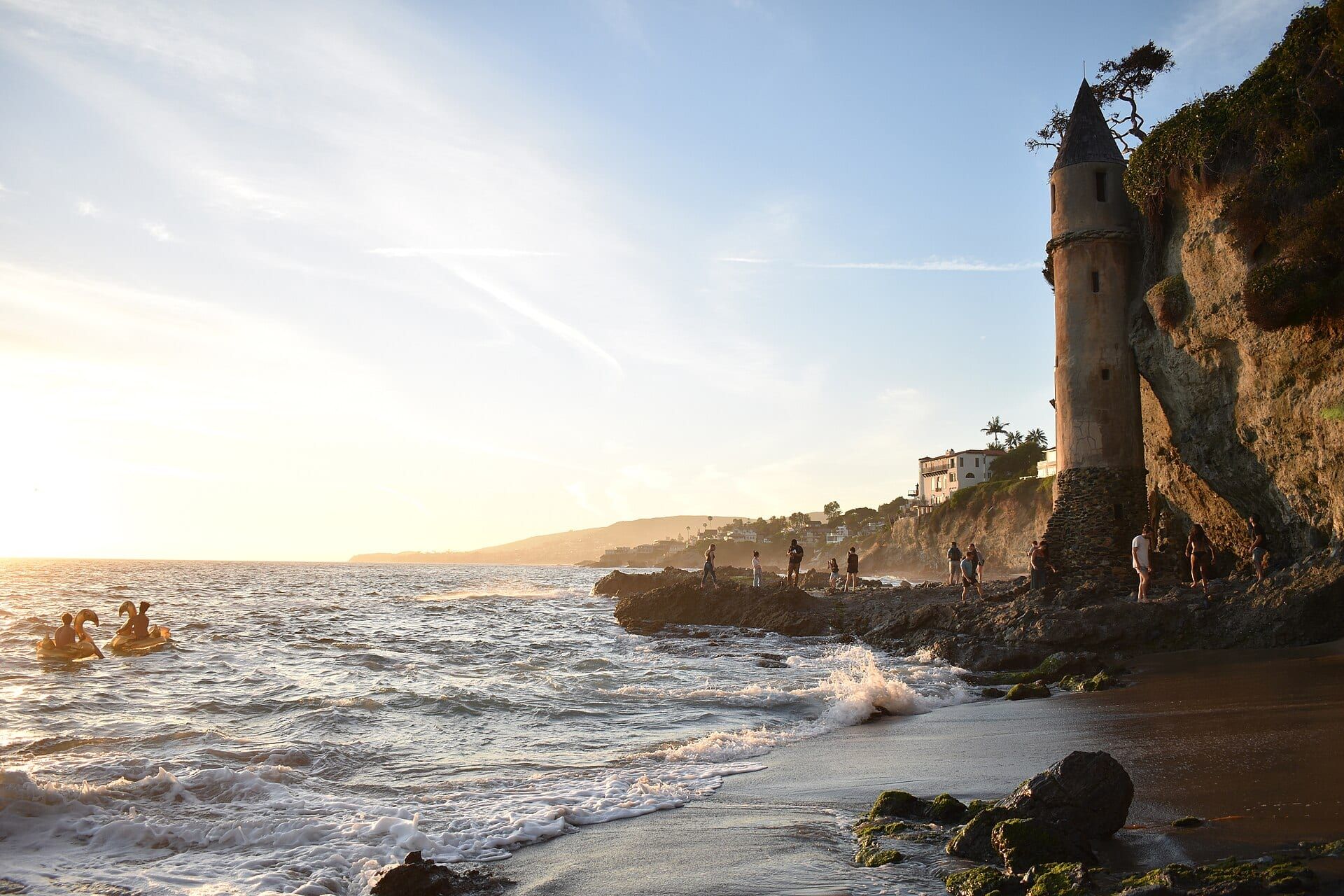
Victoria Beach is a sandy beach with a rocky shore south of Woods Cove, and the neighborhood above it carries the name.
Photo: Carl Glover, CC BY 2.0
What it’s like
Victoria Beach is a sandy beach with a rocky shore, and the neighborhood above it takes the name. Realatrends.com’s listings show addresses on Victoria Drive, Sunset Terrace, Rockledge Road, Nyes Place and Ocean Front. Homes run from beach cottages to larger houses, many with ocean views.
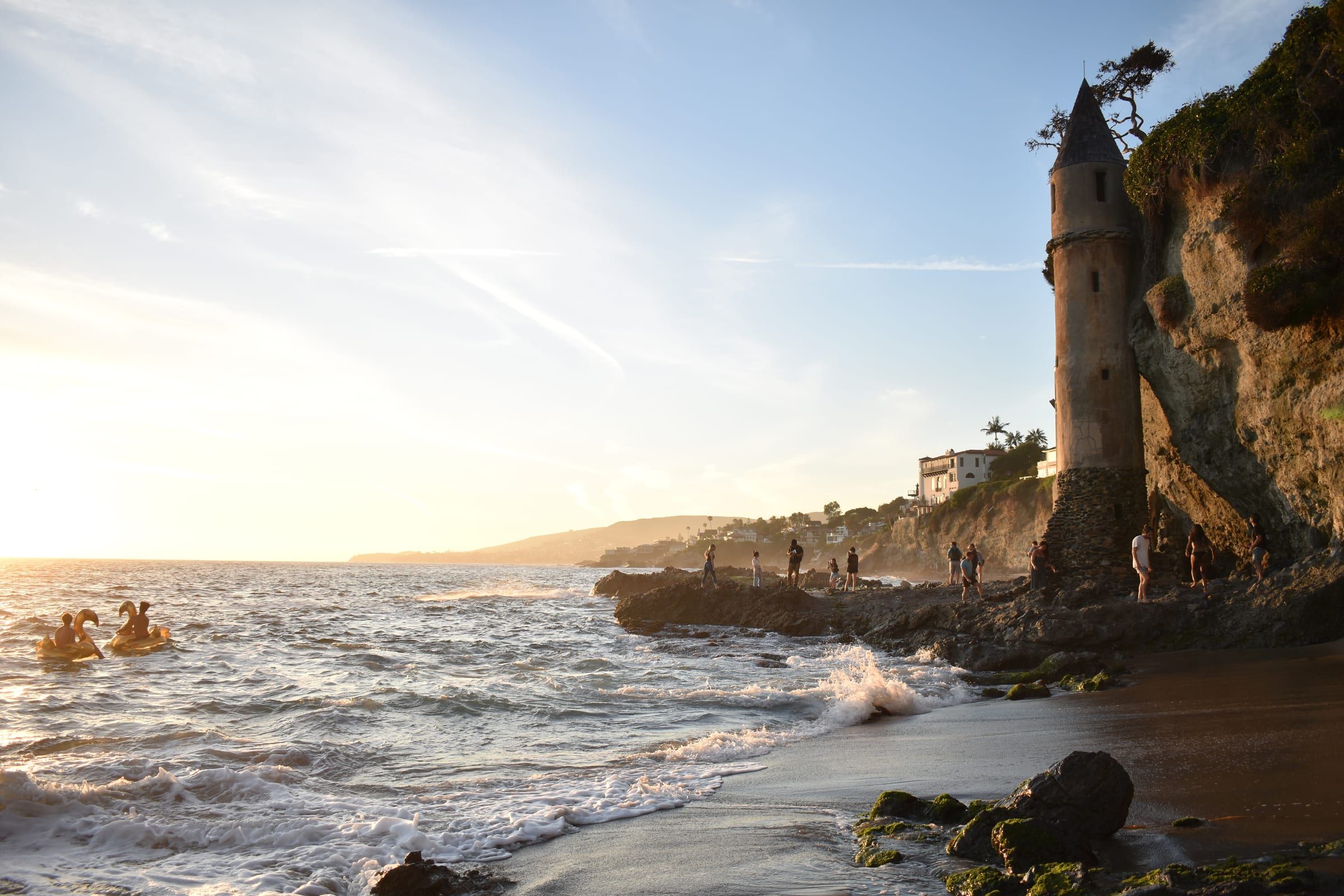
The Victoria Beach Pirate Tower is the landmark. It is a 60-foot tower of concrete and stone, built in 1926. The tower is locked. William Edward Brown, a California state senator with a vacation home in Laguna Beach, used it as a staircase to the beach, and the design drew on castles that he and his wife saw in France. The roof is conical and shingled, and the staircase inside is wooden.
The Coastal Commission lists stairs to the beach from Victoria Drive near Sunset Terrace and from Dumond Drive, with limited on-street parking, no fee and no restrooms. The Victoria Beach page covers access in full. The next listed access point south is Treasure Island Beach, which has a parking structure on Wesley Drive with a fee, restrooms, tide pools and disabled access, according to its record. See the Treasure Island beach page.
The Laguna Beach State Marine Reserve runs along the coast from Abalone Point south to Goff Island. Goff Island lies about half a mile south of Victoria Beach, so the beach falls inside the reserve. It is unlawful there to injure, damage, take or possess any living, geological or cultural marine resource. The shoreline just south has its own neighborhood pages for Lagunita and Blue Lagoon. To the north, see Woods Cove.
Getting around
Coast Highway passes the neighborhood. The free Coastal Route trolley runs on it between North Laguna and Heisler Park, downtown and South Laguna. On the off-season schedule, which covers September 8, 2026 to June 25, 2027, it comes every 20 to 30 minutes. Laguna Local, the city’s free on-demand shared ride, lists three stops on Coast Highway here: Rockledge Road and Sunset Terrace southbound, and Victoria northbound. You book by app, online or through transit dispatch.
Street parking near the stairs is limited. Aliso Beach Park lies about a mile south in a straight line, and the South Laguna page covers the coast beyond it. The parking guide covers city permits and lots, and the getting around guide covers the trolley.
Things to know before you buy or rent
Oceanfront and bluff-top lots carry extra review. The city’s design review sends shoreline and bluff protective devices to a public hearing, as it does any improvement taller than 15 feet. Grading over 20 cubic yards outside the building footprint and retaining walls over 5 feet in exposed height go to a hearing too. Development that is subject to design review, or exempt from it, may still need a coastal development permit.
If a cottage is a historic resource, major changes go to design review unless they qualify for administrative approval. Ask the city’s planners whether a cottage carries a historic designation before you plan work.
The water provider depends on location. The Laguna Beach County Water District supplies most of the city, and the South Coast Water District supplies South Laguna. Confirm which one serves an address.
Laguna Beach Unified School District operates the public schools in town. For school names and locations, see the schools guide. Realatrends.com’s Victoria Beach guide lists the homes for sale now and the most recent sales.
Things to do
Things to do near Victoria Beach
-
-
-
-
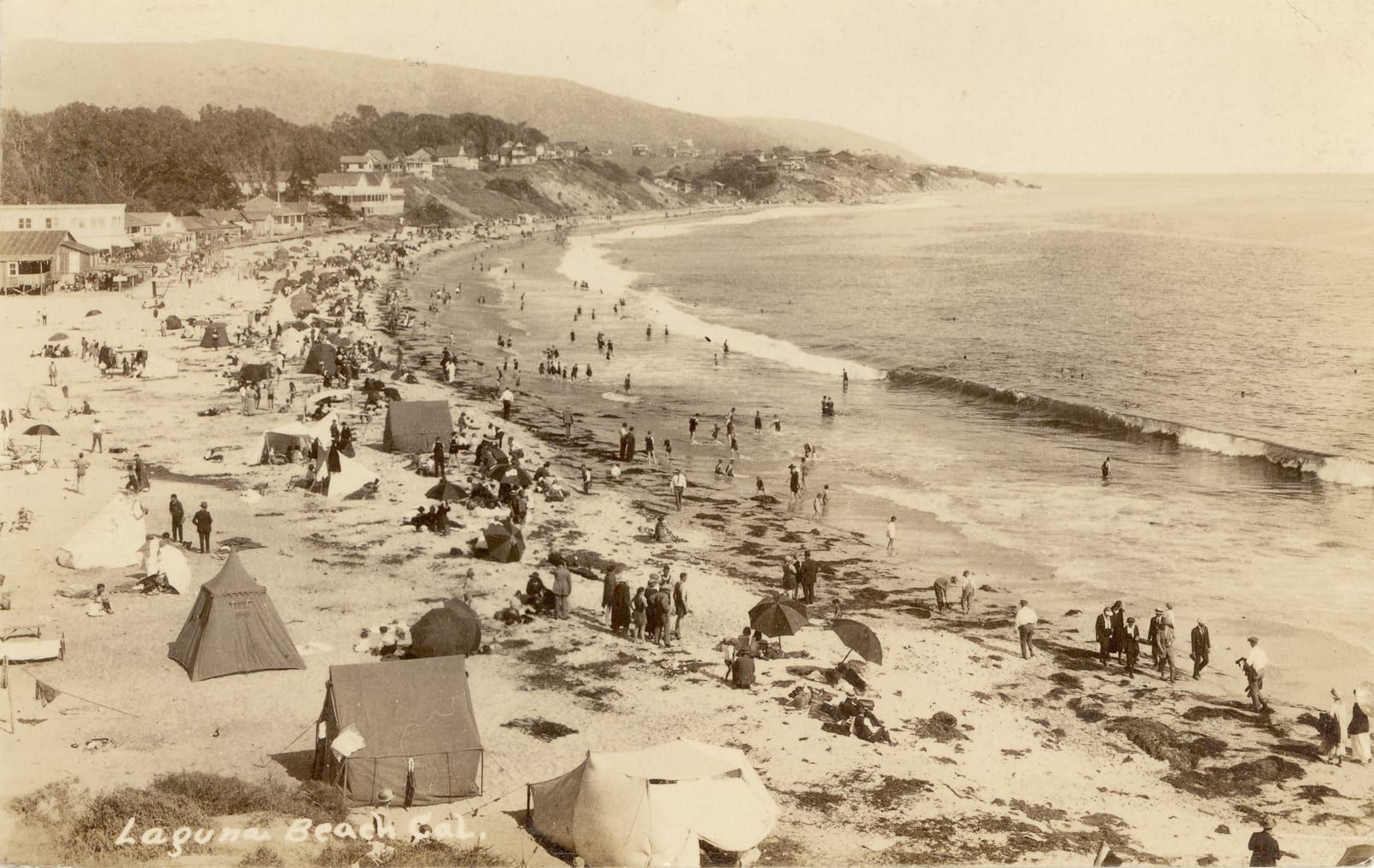
-
-

Questions
How do you get down to Victoria Beach?
The Coastal Commission lists stairs from Victoria Drive near Sunset Terrace and from Dumond Drive. It lists limited on-street parking and no restrooms.
What is the Victoria Beach Pirate Tower?
It is a 60-foot tower of concrete and stone, built in 1926 and used as a staircase to the beach. The tower is locked.
Is Victoria Beach inside a marine reserve?
Yes. The Laguna Beach State Marine Reserve runs south from Abalone Point to Goff Island, which lies south of Victoria Beach. Taking marine resources there is unlawful.
Does Laguna Local stop at Victoria Beach?
The city's Laguna Local map lists stops on Coast Highway at Rockledge Road, Sunset Terrace and Victoria. You book rides by app, online or through transit dispatch.
Questions about Victoria Beach?
Ask a local broker about streets, homes, rentals or timing.
Last reviewed
Sources (10)
- Victoria Beach coordinates; stairs from Victoria Dr. near Sunset Terrace and from Dumond Dr.; limited on-street parking; no fee; no restrooms; Aliso Beach Park coordinates (33.5094, -117.7519) for the straight-line distance; sandy beach with rocky shore; Treasure Island Beach has a parking structure at Wesley Dr. with a fee, restrooms, tide pools and disabled access: api.coastal.ca.gov, checked 2026-10-09
- Victoria Beach is a seaside community with a mix of beach cottages and luxury homes, many with ocean views; listings sit on Victoria Drive, Sunset Terrace, Nyes Place, Rockledge Road and Ocean Front; 100 Rockledge Road is an oceanfront estate above Victoria Beach: realatrends.com, checked 2026-10-09
- The Victoria Beach Pirate Tower is a 60-foot tower of concrete with a base of ocean stones, built in 1926; it is locked from entry; it was used as a staircase to the beach by William Edward Brown, a state senator with a vacation home in Laguna Beach, and the design was inspired by castles he and his wife saw in France; conical shingled roof and wooden interior staircase: en.wikipedia.org, checked 2026-10-09
- The Laguna Beach State Marine Reserve runs from Abalone Point south to Goff Island, bounded by the mean high tide line and a southern edge at 33 degrees 30.713 minutes north; it is unlawful to injure, damage, take or possess any living, geological or cultural marine resource: wildlife.ca.gov, checked 2026-10-09
- Goff Island coordinates (33.5134, -117.7606), used for the distance from Victoria Beach: nominatim.openstreetmap.org, checked 2026-10-09
- Laguna Local stops: Coast Hwy SB @ Rockledge Road, Coast Hwy @ Sunset Terrace SB, Coast Hwy NB @ Victoria: lagunabeachcity.net, checked 2026-10-09
- Laguna Local is a free on-demand shared ride between residential neighborhoods and activity centers; the Coastal Route trolley runs on Coast Highway between North Laguna/Heisler Park, downtown and South Laguna every 20 to 30 minutes on the off-season schedule (Sept. 8, 2026 to June 25, 2027): lagunabeachcity.net, checked 2026-10-09
- Design review covers shoreline and bluff protective devices and major changes to historic resources that do not qualify for administrative approval; development subject to design review, or exempt from it, may still need a coastal development permit; improvements above 15 feet, grading over 20 cubic yards outside the building footprint and retaining walls over 5 feet in exposed height go to a public hearing: ecode360.com, checked 2026-10-09
- Laguna Beach County Water District supplies water to most of Laguna Beach; South Coast Water District serves South Laguna: lagunabeachcity.net, checked 2026-10-09
- Laguna Beach Unified School District operates the public schools in Laguna Beach: lagunabeachcity.net, checked 2026-10-09