Emerald Bay · Private beach · State Marine Reserve
Emerald Bay Beach
Emerald Bay Beach lies below a gated community in unincorporated Orange County, outside the Laguna Beach city limits. Land access is for residents and their guests.
Private beach. Land access is reserved for residents.
What it’s like
Emerald Bay is a gated community on the Laguna Beach coast, and it lies outside the city limits. It belongs to unincorporated Orange County, and the Laguna Beach County Water District serves it. The Coastal Commission places Irvine Cove between Emerald Bay and the El Moro Cove mobile home park, so Irvine Cove sits up the coast.
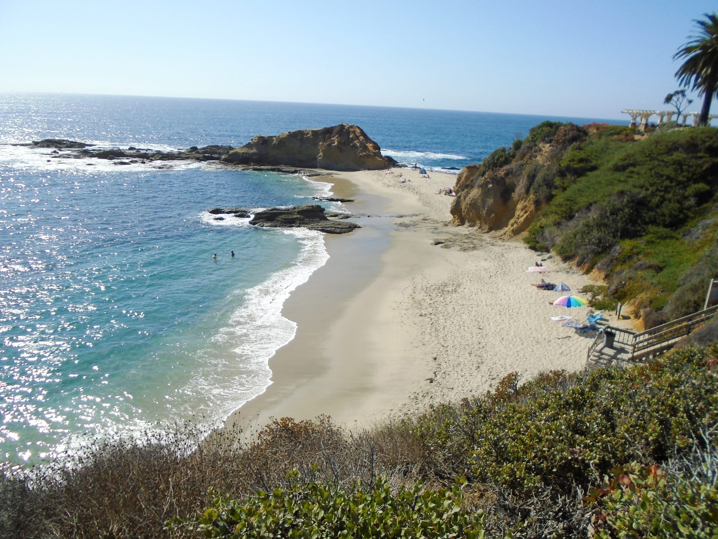
The community’s crescent beach lies below the homes, and many of them have direct beach access. The homes range from Mediterranean estates to modern coastal designs. Residents share a clubhouse and tennis courts.
The Emerald Bay neighborhood page covers the setting and the homes.
Getting there and parking
Land access to Emerald Bay Beach is for residents and their guests. The community has gated entrances.
The Coastal Commission keeps a list of public access points along the Laguna Beach coast. That list has no entry for Emerald Bay or Irvine Cove. Its northernmost Laguna entry is Smithcliffs View Park, a blufftop overlook off Smithcliffs Road. The entry describes a pedestrian entrance beside the vehicle gate and a walkway to the overlook. It lists no parking and no stairs or path to the beach.
For a public beach, go down the coast to Crescent Bay. It has a ramp and stairs from Cliff Drive, restrooms and outdoor showers.
Rules and safety
The marine reserve covers the water off Emerald Bay. The Laguna Beach State Marine Reserve starts at Abalone Point, the northern city limit, and runs 4.4 miles of shoreline to Goff Island. Emerald Bay lies on that stretch. State rules make it unlawful to injure, damage, take or possess any living, geological or cultural marine resource, and fishing is not allowed.
The state describes rocky intertidal zones, shallow kelp-filled reefs, and clear water where leopard sharks, garibaldi and California halibut turn up. Seals, sea lions and migrating whales pass along the coast. Waves and currents move more than 200,000 cubic meters of sand along this coast each year, and the state calls the beach landscape ever-changing.
The city’s beach rules, such as its closing hours and dog hours, apply on city beaches. Emerald Bay sits outside the city, so ask the community association for its own beach rules.
Good to know
Emerald Bay lies outside the city limits but inside the Laguna Beach Unified School District, according to the city’s parking permits page. The Laguna Beach County Water District supplies its water.
Irvine Cove, up the coast, is the next gated community, and its beach also has land access for residents and their guests only. Public access begins down the coast at Smithcliffs View Park and Crescent Bay. The parking guide and getting around cover the practical side of a visit.
Live from NOAA
Tides and water at Emerald Bay
| Day | High and low tides |
|---|---|
| Loading NOAA predictions… | |
Sources: NOAA tide predictions, station 9410580 and NOAA NDBC buoy 46253 (owned by Scripps). The buoy reads open water offshore; water at the beach can differ. Check posted lifeguard flags before you swim.
Things to do
Things to do at Emerald Bay
Living nearby
Emerald Bay, by the numbers
The closest neighborhood to Emerald Bay Beach. Read the Emerald Bay guide.
CRMLS: homes for sale today; closed sales in the 12 months through October 19, 2026. A median needs 5 sales.
Questions
Can the public use Emerald Bay Beach?
Land access is for residents and their guests. The beach lies below a gated community. The nearest public beach down the coast is Crescent Bay.
Is Emerald Bay part of the city of Laguna Beach?
No. Emerald Bay is an unincorporated community in Orange County, outside the city limits. It lies inside the Laguna Beach Unified School District and takes its water from the Laguna Beach County Water District.
Is Emerald Bay Beach in a marine reserve?
Yes. The Laguna Beach State Marine Reserve covers the shoreline from Abalone Point to Goff Island, and Emerald Bay lies between those points. It is unlawful to take or possess marine resources there, and fishing is not allowed.
What public coast is nearest Emerald Bay?
The Coastal Commission lists Smithcliffs View Park, a blufftop overlook off Smithcliffs Road with no parking, and Crescent Bay, a public beach with a ramp from Cliff Drive.
Moving to Laguna Beach?
Get the printable moving checklist by email: what to do before you move, moving week and your first 30 days.
Last reviewed
Sources (11)
- Emerald Bay is an unincorporated community, served by the Laguna Beach County Water District: lbcwd.org, checked 2026-10-09
- Emerald Bay is outside the city boundaries but inside the Laguna Beach Unified School District: lagunabeachcity.net, checked 2026-10-09
- Emerald Bay is a gated community known for its crescent beach, homes from Mediterranean estates to modern coastal designs, many with direct beach access; residents have a clubhouse, tennis courts and beach access reserved for them: realatrends.com, checked 2026-10-09
- Emerald Bay has gated entrances: realatrends.com, checked 2026-10-09
- Irvine Cove lies between Emerald Bay and the El Moro Cove mobile home park, a private locked-gate community; the nearest public access to the shore in 2002 was Crescent Bay downcoast and Crystal Cove State Park upcoast (staff report dated April 18, 2002): documents.coastal.ca.gov, checked 2026-10-09
- Public access list for Laguna Beach north: Smithcliffs View Park (pedestrian entry beside the vehicle gate, walkway to a blufftop overlook, no parking, no stairs or path to the beach) and Crescent Bay (ramp from Cliff Drive, stairs and path to the beach, on-street parking, restrooms); no entries for Emerald Bay or Irvine Cove: api.coastal.ca.gov, checked 2026-10-09
- Laguna Beach State Marine Reserve: 6.72 square miles, 4.4 miles of shoreline from Abalone Point to Goff Island; unlawful to injure, damage, take or possess any living, geological or cultural marine resource; no fishing; rocky intertidal, kelp reefs, leopard sharks, garibaldi, California halibut, marine mammals; about 200,000 cubic meters of sand move along the coast each year; boundary runs along the shore from 33 deg 33.224 min N, 117 deg 49.184 min W (Abalone Point) to 117 deg 45.264 min W (Goff Island), so Emerald Bay, at about 117 deg 48.64 min W, lies inside it: wildlife.ca.gov, checked 2026-10-09
- Emerald Bay position (OpenStreetMap), south of the reserve's northern boundary at Abalone Point: nominatim.openstreetmap.org, checked 2026-10-09
- Irvine Cove beach outline lies northwest of Emerald Bay (OpenStreetMap): openstreetmap.org, checked 2026-10-09
- Abalone Point position (OpenStreetMap): nominatim.openstreetmap.org, checked 2026-10-09
- Crescent Bay Beach page: public beach with restrooms and outdoor showers off Cliff Drive: lagunabeachcity.net, checked 2026-10-09