Two roads in and out
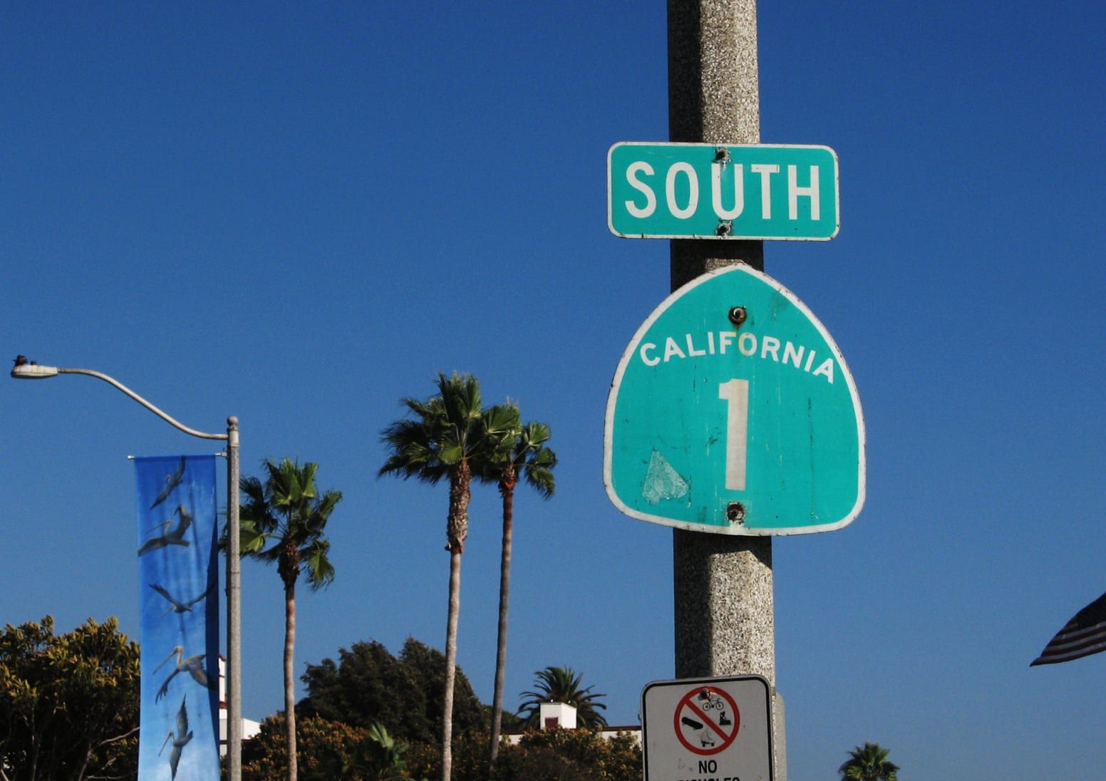
Pacific Coast Highway, State Route 1, runs along the coast and connects Laguna Beach to Newport Beach on one side and Dana Point on the other. Visit Laguna Beach calls it the slower, scenic way in.
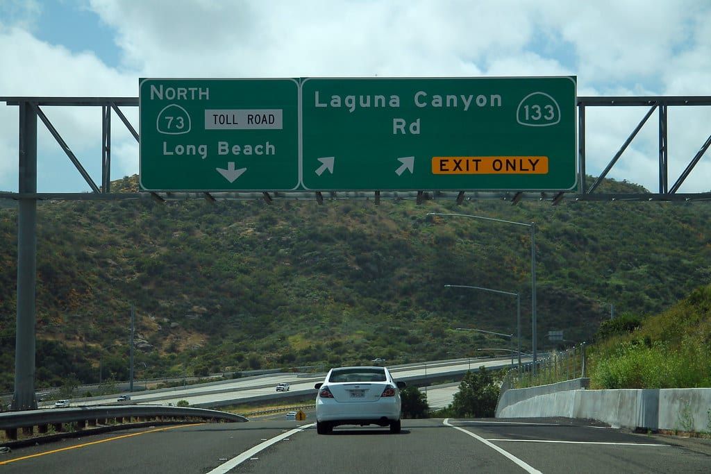
Laguna Canyon Road is State Route 133. From the 405, take the exit for Highway 133 and head south. The road turns into Laguna Canyon Road, then becomes Broadway as it enters the Village. Heading inland, it passes El Toro Road and then the 73 toll road on its way to the 405. Visit Laguna Beach gives the same directions from the north, south and east, with the coast highway as the alternative.
The 73 is a toll road. The Toll Roads, which serves State Routes 73, 133, 241 and 261, calls FasTrak the preferred way to pay and offers an online option for drivers without an account. Its site also has a toll calculator for a planned trip.
Drive distances from Main Beach
These distances come from OpenStreetMap driving routes that start at Main Beach. They give miles, not minutes, because traffic changes the time on every one of these drives.
- Fashion Island, Newport Beach: 7.9 miles
- Dana Point Harbor (Dana Wharf): 8.2 miles
- Irvine Spectrum: 9.8 miles
- John Wayne Airport: 15.0 miles
- South Coast Plaza, Costa Mesa: 15.8 miles
- Disneyland: 24.8 miles
- Downtown Los Angeles: 50.5 miles
- Los Angeles International Airport: 55.2 miles
- Downtown San Diego: 72.4 miles
Visit Laguna Beach lists Uber and Lyft as options from John Wayne Airport. If you will commute, test the drive at the hour you will make it. Do it on a weekday and on a summer weekend. See the house hunting trip guide for a planning checklist.
Speed limits set in city code
The city council has set prima facie speed limits on a handful of segments in the municipal code:
- El Toro Road, between Laguna Canyon Road and the 73: 45 mph.
- Park Avenue: 35 mph from Wendt Terrace to 1075 Park Avenue, 40 mph from there to Tahiti Avenue, and 35 mph from Tahiti Avenue to Alta Laguna Boulevard.
- Glenneyre Street, between Park Avenue and Calliope Street: 30 mph.
- Alta Laguna Boulevard: 30 mph on the segments the code lists.
- Cliff Drive, between Coast Highway and Acacia Drive: 30 mph.
- Bluebird Canyon Drive, between Cress Street and Oriole Drive: 25 mph. Nyes Place and Thalia Street also carry 25 mph on the segments listed.
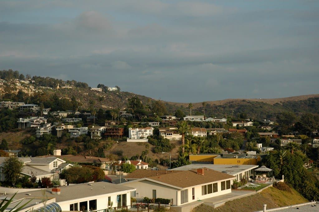
Read the posted sign on any street you drive. Outside the central area, the hillside neighborhoods are steep.
The free trolley
The city runs free trolleys. The off-season schedule runs from September 8, 2026 to June 25, 2027.
Coastal Route. It follows Coast Highway between North Laguna and Heisler Park, downtown, South Laguna and Mission Hospital, and the Ritz-Carlton in Dana Point. A trolley comes every 20 to 30 minutes at these hours:
- Monday through Thursday: 7:30 a.m. to 6 p.m.
- Friday: 7:30 a.m. to 10 p.m.
- Saturday: 9 a.m. to 10 p.m.
- Sunday: 9 a.m. to 7 p.m.
Canyon Route. On Saturdays and Sundays from 9 a.m. to 7 p.m., park at Lot 16, the Act V lot at 1900 Laguna Canyon Road, for $5 and ride a free trolley downtown every 30 minutes. The lot is closed to the public Monday through Friday.
Summer. The trolley runs year-round, with extra routes in summer. The city’s Summer Breeze loop starts at a free lot at 16355 Laguna Canyon Road in Irvine, near the I-405 and SR-133 interchange. The city’s page lists service from May 22 to September 6, every 30 minutes, with stops at the art festivals and downtown, where riders connect to the Coast Highway trolley in both directions. It does not run on July 4. The city’s trolley page lists only the off-season Coastal Route hours at this writing, so confirm summer hours and holiday schedules with the city before you plan around them.
The city also publishes a 2026 Parking and Transit Reference Guide and a holiday schedule for transit services. To charter a trolley for an event, the city offers rentals from mid-September through mid-June, with reservations taken no more than 45 days and no sooner than 10 days before the date.
You can track a trolley in real time with the Laguna Beach Trolley app or the city’s Transit Navigator page. Pair the trolley with parking and permits when you plan a day in the Village.
Laguna Local
Laguna Local is a free, on-demand, shared-ride service between residential neighborhoods and major activity centers inside the city. In the non-summer season it runs these hours:
- Monday through Thursday: 8 a.m. to 6 p.m.
- Friday: 8 a.m. to 10 p.m.
- Saturday: 9 a.m. to 10 p.m.
- Sunday: 9 a.m. to 7 p.m.
Book through the Laguna Beach Transit app for iOS or Google Play, on the city’s TripShot website, or by calling transit dispatch at (949) 497-0766 during operating hours. The city has paused bicycle carriage on Laguna Local, so confirm before you plan a ride with a bike. The city’s trolley page links a Laguna Local service map, a city guide map and a map by area, so check the map for your address. Questions go to lagunabeachlocal@lagunabeachcity.net.
Buses
OCTA Route 1 runs from Long Beach to San Clemente along Pacific Coast Highway, and it serves Laguna Beach. On OCTA’s line map, the route passes through Corona del Mar, Laguna Beach and Dana Point. Visit Laguna Beach lists the downtown Laguna Beach Bus Depot among the stops that OCTA buses reach. The city’s Lot 15, the Transit Depot, sits at 362 Ocean Avenue. Check OCTA’s current timetable before you ride.
Biking and walking
City code sets the bike rules:
- Bicycles are unlawful on any sidewalk, on the Main Beach Boardwalk and anywhere inside a city park.
- Electric bicycles follow the city’s separate chapter. Ride in the same direction as traffic, yield as the Vehicle Code requires and obey posted signs.
- No electric bicycle or other motorized conveyance may go faster than 25 miles per hour on a public highway, trail, path or park.
- Operators and passengers under 18 must wear a helmet.
- Fines start with an administrative fine of up to $100 for a first violation, and officers may impound a device when a violation endangers others.
On foot, the blufftop paths in Heisler Park lead down to beaches, and many street ends in Central Laguna have a stair to the sand. Thousand Steps Beach has a long stairway of its own. See Main Beach and Thousand Steps for those approaches, and the Village for the setting around the shops and galleries.
Charging an electric vehicle
City lots have charging stations that use ChargePoint. Register with ChargePoint before you leave home. The rate is $2 an hour to charge for up to four hours, and a car at a charging station does not need a separate parking pass. See Parking and permits for the lots.
Golf carts and low-speed vehicles
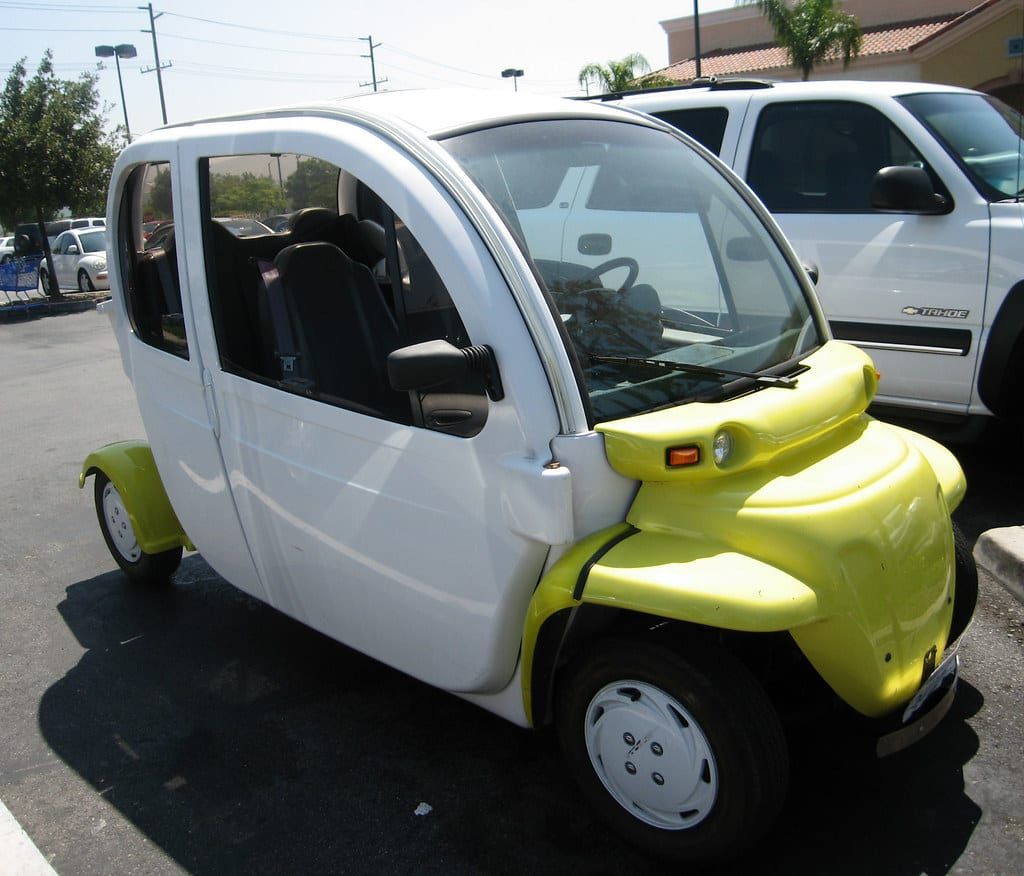
City code bars golf carts and low-speed vehicles from sidewalks on Pacific Coast Highway, in the central business district, on the Main Beach Boardwalk and in city parks. State law adds its own limits on roads and speeds. See Golf carts for the full rules.
Questions
Is the Laguna Beach trolley free?
Yes. The city runs the Coastal Route trolley and the weekend Canyon Route trolley at no charge. Laguna Local, the on-demand shared ride service, is free too.
Which highways lead into Laguna Beach?
Pacific Coast Highway (State Route 1) runs along the coast. Laguna Canyon Road (State Route 133) comes in from the inland side and connects to the 405.
How far is John Wayne Airport from Laguna Beach?
It is 15.0 miles by road from Main Beach, according to an OpenStreetMap route. Traffic changes the time, so test the drive at the hour you plan to make it.
Can you ride a bicycle on Laguna Beach sidewalks?
No. City code makes it unlawful to ride a bicycle on any sidewalk, on the Main Beach Boardwalk or anywhere inside a city park.
Get the moving checklist
The printable checklist by email: before you move, moving week and your first 30 days.
Living here
More for your move
-
- Schools The Laguna Beach Unified School District runs the public schools in town. This guide names each school, says where it is and explains how attendance, enrollment and transfers work.
-
-
-
-
Last reviewed
Sources (29)
- Closest freeway is the 405 with the closest exit at Highway 133; from the north, south or east take Hwy 133 South, which turns into Laguna Canyon Road and becomes Broadway; the 73 is the toll road option; Pacific Coast Highway hugs the coastline; the OCTA bus serves the downtown Laguna Beach Bus Depot: visitlagunabeach.com, checked 2026-10-09
- Caltrans: SR-133 is one of two State Highways that connect Laguna Beach to the rest of Orange County, the other being State Route 1 (SR-1), Pacific Coast Highway: files.ceqanet.lci.ca.gov, checked 2026-10-09
- Caltrans: SR-133, also known as Laguna Canyon Road, a north-south route from SR-1 in Laguna Beach past Canyon Acres Drive to I-405, I-5 and the SR-241 toll section: files.ceqanet.lci.ca.gov, checked 2026-10-09
- Caltrans District 12: SR-133 in Laguna Beach from just south of El Toro Road to SR-73 (Post Miles 3.1 to R4.1): ceqanet.lci.ca.gov, checked 2026-10-09
- Caltrans traffic counts by postmile: Route 1 runs through Dana Point, Laguna Beach and Newport Beach; Route 133 runs from Route 1 in Laguna Beach past El Toro Road to Route 405: dot.ca.gov, checked 2026-10-09
- The Toll Roads serves State Routes 73, 133, 241 and 261; FasTrak is the preferred way to pay; pay-without-an-account portal; toll calculator: thetollroads.com, checked 2026-10-09
- Driving distance from Main Beach to Fashion Island, 7.9 miles (OSRM route on OpenStreetMap data): router.project-osrm.org, checked 2026-10-09
- Driving distance from Main Beach to Dana Wharf in Dana Point Harbor, 8.2 miles: router.project-osrm.org, checked 2026-10-09
- Driving distance from Main Beach to Irvine Spectrum, 9.8 miles: router.project-osrm.org, checked 2026-10-09
- Driving distance from Main Beach to John Wayne Airport, 15.0 miles: router.project-osrm.org, checked 2026-10-09
- Driving distance from Main Beach to South Coast Plaza, 15.8 miles: router.project-osrm.org, checked 2026-10-09
- Driving distance from Main Beach to Disneyland, 24.8 miles: router.project-osrm.org, checked 2026-10-09
- Driving distance from Main Beach to downtown Los Angeles, 50.5 miles: router.project-osrm.org, checked 2026-10-09
- Driving distance from Main Beach to Los Angeles International Airport, 55.2 miles: router.project-osrm.org, checked 2026-10-09
- Driving distance from Main Beach to downtown San Diego, 72.4 miles: router.project-osrm.org, checked 2026-10-09
- Coastal Route: free, between North Laguna/Heisler Park, downtown, South Laguna/Mission Hospital and the Ritz Carlton in Dana Point; hours by day; every 20 to 30 minutes; off-season September 8, 2026 to June 25, 2027; Canyon Route on weekends from Lot 16; real-time tracking app; Laguna Local hours, booking, service maps, email contact and bike suspension: lagunabeachcity.net, checked 2026-10-09
- Summer Breeze trolley loop from Irvine, May 22 to September 6, every 30 minutes, connects to the Coast Highway trolley downtown: lagunabeachcity.net, checked 2026-10-09
- Trolley runs year-round with expanded summer routes: realatrends.com, checked 2026-10-09
- Summer Season Trolley Routes (June 26 to Sept. 7, 2026) added a daily Canyon Route, a daily Coastal Route and the Summer Breeze route (read via Wayback capture of 2026-06-14): lagunabeachcity.net, checked 2026-10-09
- OCTA Route 1 runs from Long Beach to San Clemente via Pacific Coast Highway through Laguna Beach: octa.net, checked 2026-10-09
- Lot 15 is the Transit Depot at 362 Ocean Avenue: lagunabeachcity.net, checked 2026-10-09
- Municipal code 10.02.020: bicycles unlawful on any sidewalk, the Main Beach Boardwalk or any area within a city park; golf carts and low speed vehicles barred from sidewalks on Pacific Coast Highway, in the central business district, on the Boardwalk and in city parks: ecode360.com, checked 2026-10-09
- Municipal code chapter 10.16: electric bicycles ride with traffic, yield, obey signs, 25 mph cap, helmet for riders and passengers under 18, administrative fines, impound: ecode360.com, checked 2026-10-09
- Municipal code 10.02.050 prima facie speed limits on listed segments: El Toro Road 45, Park Avenue 35 and 40, Glenneyre Street 30, Alta Laguna Boulevard 30, Temple Hills Drive 25 and 30, Cliff Drive 30, Bluebird Canyon Drive 25, Thalia Street 25, Nyes Place 25: ecode360.com, checked 2026-10-09
- ChargePoint registration before arrival; $2 an hour to charge for up to four hours at city lots: lagunabeachcity.net, checked 2026-10-09
- Outside the central zone the hillside neighborhoods are steep: realatrends.com, checked 2026-10-09
- From John Wayne Airport you can use Uber or Lyft: visitlagunabeach.com, checked 2026-10-09
- City publishes a 2026 Parking and Transit Reference Guide and a holiday schedule for transit; trolley charters mid-September through mid-June, booked no more than 45 days and no sooner than 10 days before the event: lagunabeachcity.net, checked 2026-10-09
- Heisler Park has blufftop paths to the beach; stairs at most street ends in Central Laguna; Thousand Steps Beach has a long stairway: api.coastal.ca.gov, checked 2026-10-09