Outdoors · OC Parks
Aliso Peak trail
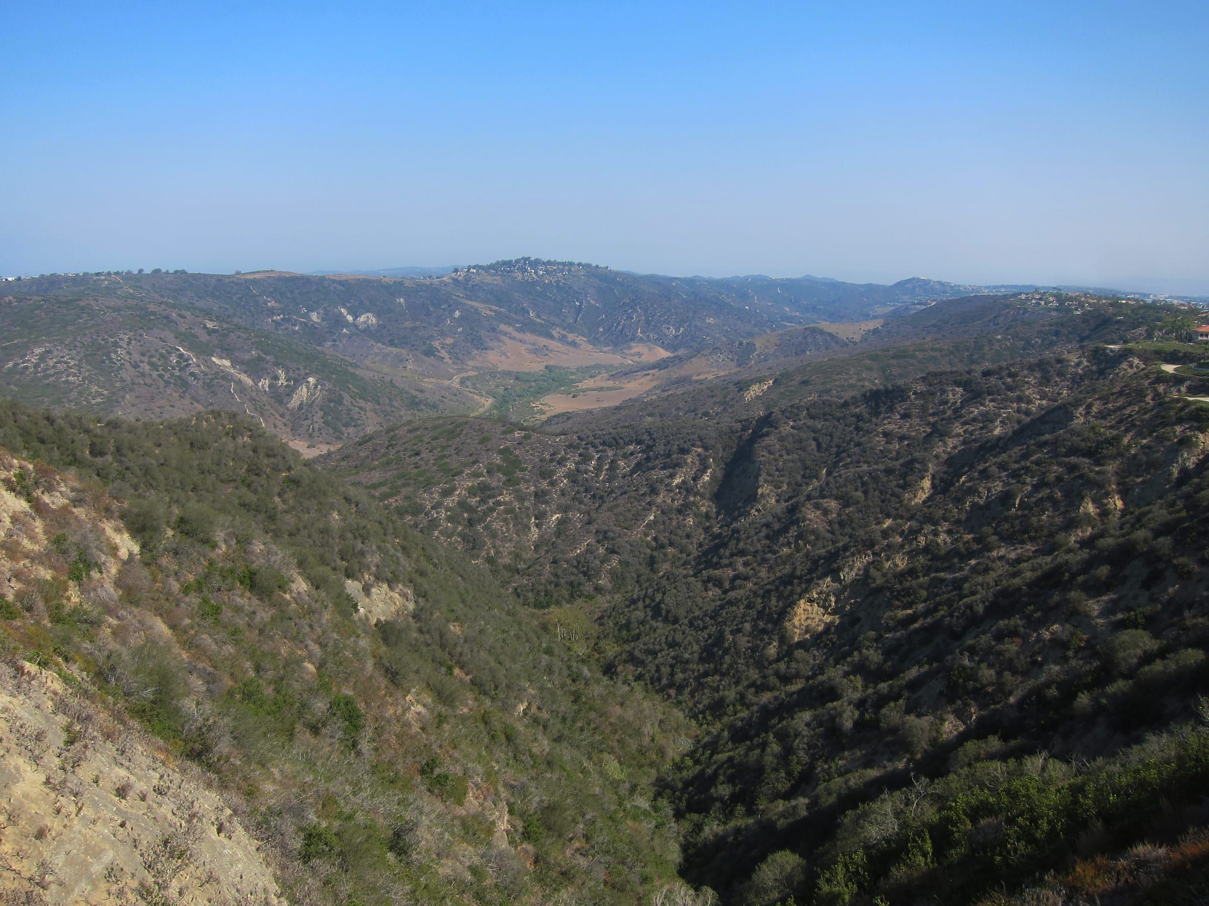
Aliso Peak is a 683-foot overlook at the coastal end of Aliso and Wood Canyons Wilderness Park, reached on OC Parks' Aliso Peak Trail from the Talavera Drive side, near Seaview Park in Laguna Niguel.
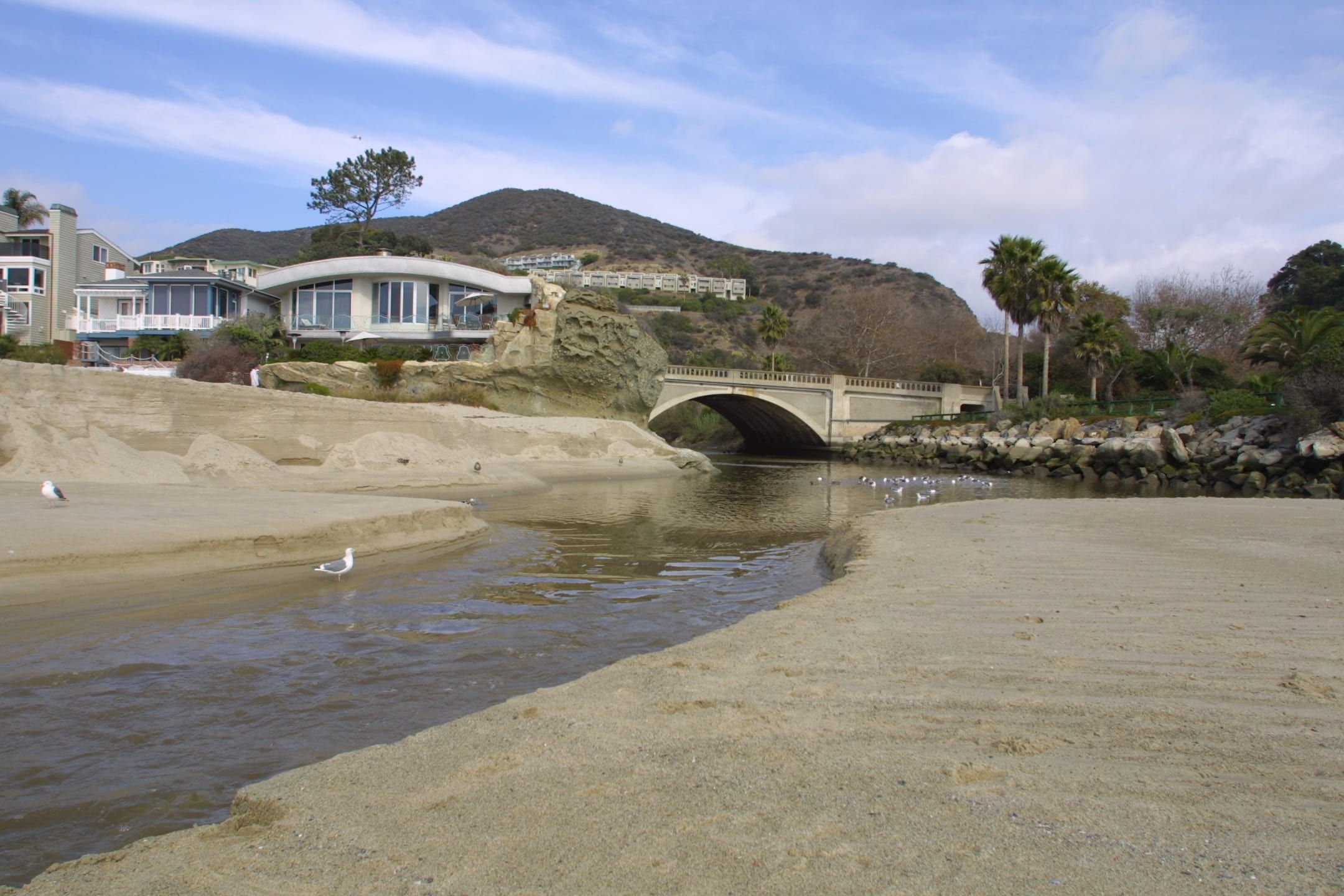
Photo: Shannon1, CC BY-SA 4.0

- Aliso Peak Trail
- Easy, 0.5 mile, hiking only, dogs allowed on the map
- Peak
- 683 feet, per OC Parks' trail map
- Start
- Talavera Drive in Laguna Niguel, per OC Parks' map; Seaview Park is at No. 22739
- Hours
- Wilderness park day use 7 a.m. to sunset
- After rain
- Trails may close for three days or more, per OC Parks
Where to go
Trails and places on the peak
- Seaview Park County-owned park on Talavera Drive with a self-guided native plant display, picnic tables and a scenic overlook, per the city of Laguna Niguel.
- Toovet Trail Easy, 0.25 mile, hiking only, dogs allowed on the map. It meets the peak.
- Valido Trail Difficult, 0.5 mile, hiking only, dogs allowed on the map. It also meets the peak.
- Aliso Beach The beach where Aliso Creek reaches the ocean, with its own city rules.
What it is
Aliso Peak is one of the high points OC Parks lists on its map of Aliso and Wood Canyons Wilderness Park. The map labels it at 683 feet and names it among the best views in the park. OC Parks’ amenities page lists it as one of the park’s scenic overlooks.
It is the park’s coastal end. The map places the peak near Pacific Coast Highway, close to where Aliso Creek reaches the ocean at Aliso Beach. The ridge entrance at Top of the World is a different start, farther north and west on the map, so the two make separate outings.
Getting to the trail
OC Parks’ map draws the Aliso Peak Trail from Talavera Drive and marks a scenic overlook symbol on the trail near that street. Seaview Park is on that street, and it is in Laguna Niguel, not Laguna Beach: the city of Laguna Niguel lists it at 22739 Talavera Drive, near the gated entrance to the Laguna Sur development. The city says the County of Orange owns and operates the park and that it has a self-guided native plant display, picnic tables and a scenic overlook.
Neither the city’s page nor OC Parks’ pages list hours, parking or rules for Seaview Park itself. Call the park office at (949) 923-2200 before you go and read any posted signs on Talavera Drive.
The trails at the peak
The trail guide on the map lists three short trails that meet at the peak:
- Aliso Peak Trail: easy, 0.5 mile, hiking only, dogs allowed.
- Toovet Trail: easy, 0.25 mile, hiking only, dogs allowed.
- Valido Trail: difficult, 0.5 mile, hiking only, dogs allowed.
The map draws Toovet and Valido trails dropping from the peak toward the Pacific Coast Highway side. These lengths are each trail’s own, not a round trip. OC Parks marks every authorized trail with posts and says all others are unauthorized.
None of the three is open to bikes or horses on the map. For bikes in the park, see mountain biking.
Hours and conditions
- Day use: 7 a.m. to sunset for the wilderness park, per OC Parks.
- Rain: OC Parks says trails may close for three days or more after rain, and its rules call the park subject to closure in rainy weather.
- Hazards: mountain lions, rattlesnakes, poison oak, extreme weather and rugged terrain. OC Parks says your safety cannot be guaranteed.
OC Parks lists a $3 daily parking fee, as of October 2026, on the park page that names the Awma Road lot off Alicia Parkway. Neither OC Parks nor the city lists a fee for Seaview Park.
Dogs
OC Parks’ own documents differ. Its rules page for the park says no pets, with horses exempt, and its Laguna Coast FAQ says dogs are not permitted in County wilderness parks. Its trail map, revised August 2023, marks Aliso Peak, Toovet and Valido trails hiking only with dogs allowed. Call the park office at (949) 923-2200 before you bring a dog.
Views
OC Parks lists the peak as a scenic overlook and places it beside the coast on its map. It does not say what you can see from the top, so this page does not either. For other places to watch the sun go down, see the sunset spots page.
How it compares with the park’s other high points
OC Parks’ map lists four spots for the best views in the park: Aliso Peak at 683 feet, Top of Meadows Trail at 817 feet, Top of Moulton Peak at 890 feet and “Top of the World” at 1,036 feet. Aliso Peak is the lowest of the four, and it is the one nearest the ocean on the map. The amenities page also names a scenic overlook along Aliso Summit Trail, which the map rates easy at 2 miles and multi-use, with dogs allowed.
Before you go
- Call (949) 923-2200 for trail conditions, especially after rain.
- Pick up the park trail map, which OC Parks says is available at the park entrance and many trailheads, or print the current PDF from the park page.
- Follow the posts. The map treats any trail without one as unauthorized.
- Leave wildlife alone. OC Parks’ rules say no feeding the animals.
- Check sunset time. The park closes at sunset.
Nearby
The Dripping Cave trail is farther north in the same park, in Wood Canyon, and the Aliso and Wood Canyons guide covers the entrances. The hiking guide compares the two OC Parks wilderness parks.
Go with a guide
Tours, rentals and lessons
| Who | What their site offers | Checked |
|---|---|---|
| OC Parks, Aliso and Wood Canyons | Park office at (949) 923-2200 for trail conditions and the park trail map |
Listed A to Z. Nobody paid to be here; we check each site and date it. Confirm times, prices and age limits with the business before you go.


Keep exploring
Related pages
-
-
-
-

-
-

Questions
How high is Aliso Peak?
OC Parks' trail map labels Aliso Peak at 683 feet and lists it among the best views in the park. The park's amenities page names it as a scenic overlook.
Where does the Aliso Peak Trail start?
OC Parks' map draws the Aliso Peak Trail from Talavera Drive, where the city of Laguna Niguel places Seaview Park at 22739 Talavera Drive. The map also shows Toovet and Valido trails meeting the peak from the Pacific Coast Highway side.
Is Aliso Peak in Laguna Beach?
The peak is at the coastal end of Aliso and Wood Canyons Wilderness Park, near Aliso Beach in South Laguna. The trail's Talavera Drive end and Seaview Park are in Laguna Niguel. OC Parks, not the city of Laguna Beach, runs the trails.
Are dogs allowed on Aliso Peak Trail?
OC Parks' trail map marks Aliso Peak, Toovet and Valido trails as hiking only with dogs allowed. Its rules page for the park says no pets, so call (949) 923-2200 before you bring one.
Thinking of moving here?
Get the printable moving checklist by email: before you move, moving week and your first 30 days.
Last reviewed
Sources (6)
- Trail map revised 2023-08-04: Aliso Peak Trail easy 0.5 mile hiking only with dogs allowed; Toovet Trail easy 0.25 mile hiking only dogs allowed; Valido Trail difficult 0.5 mile hiking only dogs allowed; Aliso Peak 683 feet listed among the best views in the park; Aliso Peak Trail drawn from Talavera Dr. with a scenic overlook symbol; Toovet and Valido trails drawn from the peak toward Pacific Coast Highway; day use 7 a.m. to sunset; authorized trails marked with posts; Aliso Creek meets the ocean near Pacific Coast Highway: parks.oc.gov, checked 2026-10-28
- Amenities page: scenic overlooks include Aliso Peak, Top of Moulton Peak, Top of the World, Top of Meadows Trail, along the Aliso Summit Trail and Top of Alwut Trail; trail maps at the park entrance and many trailheads; (949) 923-2200: parks.oc.gov, checked 2026-10-28
- Seaview Park: 22739 Talavera Drive, Laguna Niguel, near the gated entrance to the Laguna Sur development; owned and operated by the County of Orange; self-guided native plant display, picnic tables, scenic overlook; contact OC Parks staff at 949-923-2200; the page lists no hours, parking or rules: cityoflagunaniguel.org, checked 2026-10-28
- Park rules: no pets (horses exempt); no feeding the animals; fires, smoking and alcohol prohibited; minors under 18 with an adult; 10 mph speed limit; park only in designated areas; park subject to closure in rainy weather; mountain lions, rattlesnakes, poison oak and rugged terrain: parks.oc.gov, checked 2026-10-28
- Park page: hours 7 a.m. to sunset; $3 daily parking fee; enter and exit the Awma Road lot via Alicia Parkway only; trails may close three days or more after rain; about 4,500 acres: parks.oc.gov, checked 2026-10-28
- Dogs are not permitted in wilderness parks operated by the County of Orange: parks.oc.gov, checked 2026-10-28