
- Population, July 2025
- Laguna Beach 22,391; Laguna Niguel 64,107
- Land area, 2020 Census
- Laguna Beach 8.89 sq mi; Laguna Niguel 14.74 sq mi
- City dates, as each city states
- Laguna Beach founded June 29, 1927; Laguna Niguel incorporated December 1, 1989
- Public school district
- Laguna Beach USD; Capistrano USD
- Road miles to John Wayne Airport (OSRM)
- 13.5 miles; 16.6 miles (from each City Hall)
People searching “Laguna” land on four different cities. The word is Spanish for lagoon, and Laguna Niguel’s own history page says its name joins “laguna” with Nigueli, a Juaneno village once near Aliso Creek. Each city has its own council, its own rules and its own services, so a permit, a trash pickup or a school boundary in one tells you nothing about the others. This page compares Laguna Beach with Laguna Niguel and then covers the other two.
The four Lagunas
| City date, as each city states | Residents, July 2025 estimate | Land area, 2020 Census | |
|---|---|---|---|
| Laguna Beach | Founded June 29, 1927 | 22,391 | 8.89 sq mi |
| Laguna Niguel | Incorporated December 1, 1989 | 64,107 | 14.74 sq mi |
| Laguna Hills | Became a city December 20, 1991 | 30,020 | 6.55 sq mi |
| Laguna Woods | Incorporated March 24, 1999 | 16,844 | 3.34 sq mi |
Populations are the Census Bureau’s Vintage 2025 estimates and land areas come from the 2020 Census Gazetteer, the same files for all four. The Census Bureau lists each as its own city. Laguna Beach’s About page calls June 29, 1927 its founding date and gives its own area as 8.84 square miles.
Laguna Beach and Laguna Niguel side by side
| Laguna Beach | Laguna Niguel | |
|---|---|---|
| Residents, July 2025 estimate | 22,391 | 64,107 |
| Land area, 2020 Census | 8.89 sq mi | 14.74 sq mi |
| City date, as each city states | Founded June 29, 1927 | Incorporated December 1, 1989 (29th Orange County city) |
| Pacific coast, as each city describes it | 7.5 miles of city coastline | None described; the city lists Dana Point and Laguna Beach among its neighbors |
| Public school district | Laguna Beach USD | Capistrano USD |
| Form of government | Council-manager | Council-manager; General Law city |
| Council | Five members, elected at large | Five members, each elected from a district |
| Transit run by the city | Free trolley routes and Laguna Local on-demand rides | Free summer trolley, Metrolink station to Salt Creek Beach |
| Road miles to John Wayne Airport (OSRM) | 13.5 miles | 16.6 miles |
| Road miles to Los Angeles City Hall (OSRM) | 50.3 miles | 54.2 miles |
Road miles run from each City Hall on the OSRM routing engine with OpenStreetMap data. They are not official figures. The two City Halls are 8.3 road miles apart by the same method.
Size and density
Laguna Niguel has about 42,000 more residents than Laguna Beach on about 6 more square miles of land. Counted against the Census land area, that works out to about 4,350 residents per square mile in Laguna Niguel and 2,500 in Laguna Beach. Those densities are this site’s arithmetic from two Census files, not figures either city publishes.
The coast
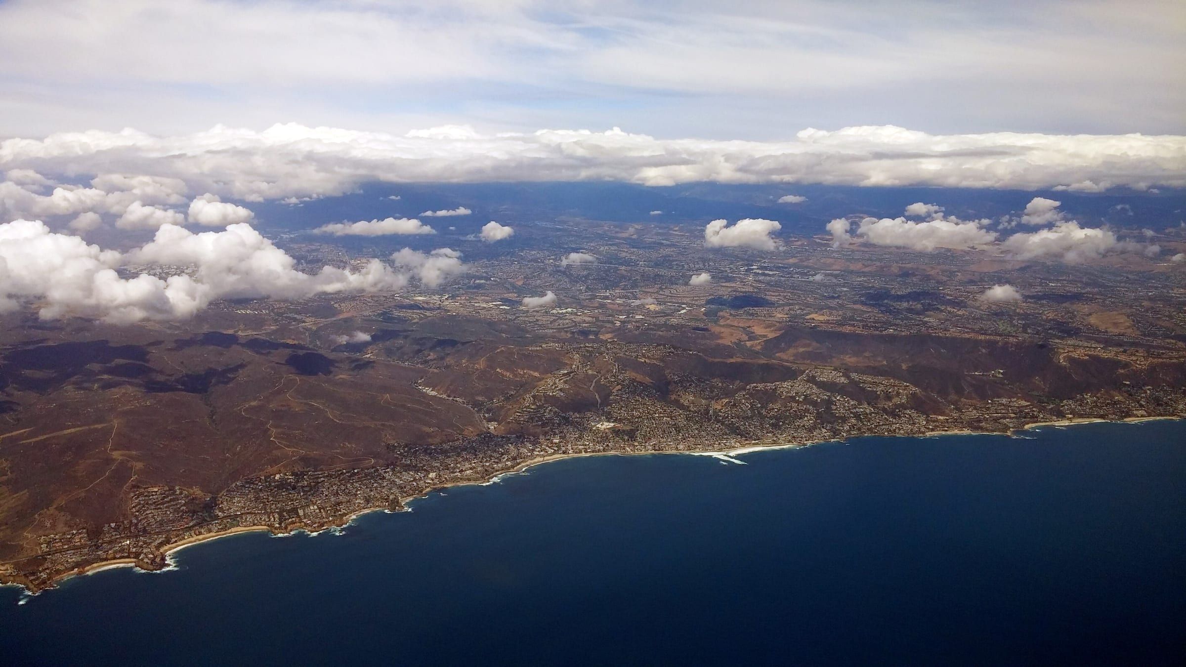
Laguna Beach Marine Safety counts seven and a half miles of city coastline, and the beaches guide covers each access point. Laguna Niguel’s About page calls the city a 14.72 square mile planned community in South Orange County. It lists Aliso Viejo, Dana Point, Laguna Beach, Laguna Hills, Mission Viejo and San Juan Capistrano as neighbors and says 3,650 of its 9,456 acres are designated parks and open space. It does not describe a shoreline. The city’s summer trolley links the Laguna Niguel/Mission Viejo Metrolink station to Salt Creek Beach, which Dana Point lists on its own beaches page and OC Parks places at a Dana Point address. For the marine protected areas off Laguna Beach, see the marine reserves guide.
Schools and government
Laguna Beach Unified has two elementary schools, one middle school and one high school. The City of Laguna Niguel says Capistrano Unified serves it, with six public elementary schools and one middle school inside the city and high schools in Dana Point and Aliso Viejo. Each district can tell you which school an address is assigned to. The schools guide lists Laguna Beach’s school names and no ratings.
Laguna Beach elects its five council members at large to four-year terms. Laguna Niguel’s council also has five members on four-year staggered terms. Under a 2024 ordinance, each member now represents a district, with districts 1, 3 and 5 elected in November 2024 and districts 2 and 4 in November 2026.
Getting around
Laguna Beach runs a free Coastal Route trolley on Coast Highway, a weekend Canyon Route and Laguna Local, a free on-demand ride service. See getting around Laguna Beach. Laguna Niguel runs a free summer trolley from Memorial Day weekend to Labor Day weekend, every 20 minutes, and says service resumes in May 2027. The city’s transportation page points to OCTA buses and Metrolink.
Laguna Hills
Laguna Hills incorporated on December 20, 1991, after 86 percent of voting residents favored it in a March 1991 vote, according to its city history. The city says its land was part of Rancho Niguel and that the Moulton Ranch was subdivided in the early 1960s. The Saddleback Valley Unified School District serves it, and the Census Vintage 2025 estimate is 30,020 residents. The city’s website is lagunahillsca.gov.
Laguna Woods
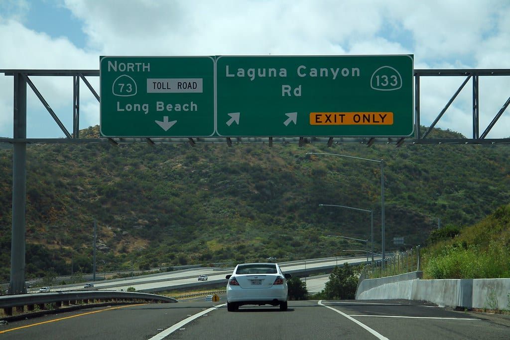
Laguna Woods incorporated on March 24, 1999, as Orange County’s 32nd city. The city calls itself a general law, council-manager and contract city of about three square miles, once part of the Moulton Ranch. It places itself just over one mile from Laguna Canyon and about five miles from the Pacific, bordered by Aliso Viejo, Laguna Beach, Laguna Hills and the Laguna Coast Wilderness Park. It lists five private communities, with Laguna Woods Village the largest. The Census estimate is 16,844 residents. Saddleback Valley USD says the city has no schools, and a district letter in a city planning document says part of Laguna Woods lies within the Laguna Beach Unified boundaries. The city’s website is lagunawoods.gov.
How to tell which city you need
- Ask the agency or check your parcel record for the city your address sits in.
- For permits, trash, parking and code questions, use the city hall of that city.
- For schools, ask the district to confirm the boundaries for your address.
- For the coast, start with the beaches guide and Laguna Beach and Dana Point compared.
Then read the neighborhoods guide, the moving guide and Laguna Beach facts.
The same comparison for other nearby cities: Laguna Beach vs Newport Beach, Dana Point, San Clemente, Huntington Beach and La Jolla.
Questions
Are Laguna Beach and Laguna Niguel the same city?
No. They are separate incorporated cities with their own city halls and councils. Laguna Beach was founded in 1927 and sits on the coast. Laguna Niguel incorporated in 1989, and its city page does not describe a coastline of its own.
Which Laguna is on the ocean?
Laguna Beach, which counts seven and a half miles of coastline. Laguna Woods says it lies about five miles from the Pacific. Laguna Niguel's city page lists Dana Point and Laguna Beach among its neighbors, and its summer trolley runs to Salt Creek Beach, which Dana Point lists among its own beaches.
Which school district serves Laguna Niguel?
The City of Laguna Niguel says it is served by the Capistrano Unified School District. Laguna Beach has its own district, Laguna Beach Unified.
How do Laguna Beach and Laguna Niguel elect their councils?
Laguna Beach elects its five council members at large. Laguna Niguel moved to by-district elections under a 2024 ordinance, with each of its five members elected from a district.
Get the moving checklist
The printable checklist by email: before you move, moving week and your first 30 days.
Living here
More for your move
-
-
-
-
-
- Schools Living here


Last reviewed
Sources (27)
- Population: Census Bureau Vintage 2025 city estimates for July 1, 2025 (Laguna Beach 22,391; Laguna Niguel 64,107; Laguna Hills 30,020; Laguna Woods 16,844): www2.census.gov, checked 2026-10-28
- Land area: Census 2020 Gazetteer, places (Laguna Beach 8.894 sq mi land; Laguna Niguel 14.736; Laguna Hills 6.548; Laguna Woods 3.342); densities of about 2,500 and 4,350 residents per square mile of land for Laguna Beach and Laguna Niguel are this site's arithmetic from the two Census files: www2.census.gov, checked 2026-10-28
- City of Laguna Beach About page: Laguna Beach occupies 8.84 square miles and was founded on June 29, 1927; the city operates under a council-manager form of government with a five-person City Council (read through a Wayback capture of October 13, 2026): lagunabeachcity.net, checked 2026-10-28
- Laguna Beach's five-member City Council is elected at large; members serve four-year terms (read through a Wayback capture of October 4, 2026): lagunabeachcity.net, checked 2026-10-28
- Laguna Beach Marine Safety protects over six million beach visitors along seven-and-a-half miles of the city's coastline (read through a Wayback capture of October 18, 2026): lagunabeachcity.net, checked 2026-10-28
- Laguna Beach Unified School District: transitional kindergarten through grade 12, two elementary schools, one middle school, one high school: lbusd.org, checked 2026-10-28
- Laguna Beach Coastal Route trolley, non-summer season September 8, 2026 to June 25, 2027: free service on Coast Highway between North Laguna/Heisler Park, downtown, South Laguna/Mission Hospital and the Ritz Carlton in Dana Point; Canyon Route on weekends; Laguna Local free on-demand shared ride (read live): lagunabeachcity.net, checked 2026-10-28
- City of Laguna Niguel About Us: a 14.72 square mile planned community in South Orange County, halfway between Los Angeles and San Diego, surrounded by the cities of Aliso Viejo, Dana Point, Laguna Beach, Laguna Hills, Mission Viejo and San Juan Capistrano; a General Law city with municipal elections in November of even-numbered years; 9,456 acres with 3,650 designated for parks and open space: cityoflagunaniguel.org, checked 2026-10-28
- City of Laguna Niguel History: the name combines the Spanish word for lagoon with Nigueli, the name of a Juaneno village once near Aliso Creek; residents formed a Community Services District in 1986; on November 7, 1989, 89 percent of voters favored incorporation, and on December 1, 1989 Laguna Niguel became the 29th city in Orange County: cityoflagunaniguel.org, checked 2026-10-28
- City of Laguna Niguel Schools: residents are served by the Capistrano Unified School District; six public elementary schools and one middle school are in the city; the high schools serving Laguna Niguel students are in Dana Point and Aliso Viejo: cityoflagunaniguel.org, checked 2026-10-28
- City of Laguna Niguel Council-Manager Form of Government: the council hires a professional manager to carry out administrative responsibilities; the mayor is selected by a majority vote of the council for one year: cityoflagunaniguel.org, checked 2026-10-28
- City of Laguna Niguel Mayor and City Council: five members serve four-year staggered terms; the council appoints a Mayor and Mayor Pro Tem each year and appoints the City Manager and City Attorney: cityoflagunaniguel.org, checked 2026-10-28
- City of Laguna Niguel Transition to District Elections: on January 16, 2024 the council adopted Ordinance No. 2023-226 establishing by-district elections; districts 1, 3 and 5 were elected in November 2024 and districts 2 and 4 in November 2026, every four years: cityoflagunaniguel.org, checked 2026-10-28
- City of Laguna Niguel Summer Trolley: free; runs Memorial Day weekend to Labor Day weekend (service resumes May 2027); runs every 20 minutes; connects the Laguna Niguel/Mission Viejo Metrolink Station to Salt Creek Beach; North Line has 5 stops between Crown Valley Park and the Metrolink station; ten stops in all: cityoflagunaniguel.org, checked 2026-10-28
- City of Laguna Niguel Public Transportation page lists the Orange County Transportation Authority for bus service and Metrolink for rail: cityoflagunaniguel.org, checked 2026-10-28
- Dana Point Beaches page lists Salt Creek Beach among the beaches of Dana Point: danapoint.org, checked 2026-10-28
- OC Parks Salt Creek Beach Park: address 33333 S. Pacific Coast Hwy., Dana Point, CA 92629 (ocparks.com now redirects to parks.oc.gov): parks.oc.gov, checked 2026-10-28
- City of Laguna Hills History: incorporation efforts began in 1987; on March 5, 1991, 86 percent of voting residents favored incorporation; on December 20, 1991 Laguna Hills officially became a city; built on Rancho Niguel land, with the Moulton Ranch subdivided in the early 1960s: lagunahillsca.gov, checked 2026-10-28
- City of Laguna Hills FAQ: the Saddleback Valley Unified School District serves Laguna Hills: lagunahillsca.gov, checked 2026-10-28
- City of Laguna Woods About Us: about three square miles that were part of the Moulton Ranch; incorporated March 24, 1999 as Orange County's 32nd city; a general law city with a council-manager form of government and a contract city; just over one mile from Laguna Canyon and about five miles from the Pacific Ocean; bordered by Aliso Viejo, Laguna Beach, Laguna Hills and the Laguna Coast Wilderness Park; five private communities, Laguna Woods Village the largest; five council members elected at large to four-year terms: lagunawoods.gov, checked 2026-10-28
- Saddleback Valley USD comment letter reproduced in the City of Laguna Woods Housing Element Update negative declaration (January 2022): Laguna Woods is within the district's boundaries and a portion of the city also lies within the Laguna Beach Unified School District: lagunawoods.gov, checked 2026-10-28
- Saddleback Valley USD About: the district serves the cities of Lake Forest and Laguna Hills and parts of Aliso Viejo, Mission Viejo, Rancho Santa Margarita and Irvine; the page says Laguna Woods has no schools: svusd.org, checked 2026-10-28
- Road distance by the OSRM routing engine on OpenStreetMap data, Laguna Beach City Hall (505 Forest Avenue) to John Wayne Airport, 13.5 miles; not an official figure: router.project-osrm.org, checked 2026-10-28
- Road distance (OSRM), Laguna Niguel City Hall (30111 Crown Valley Parkway, coordinates from OpenStreetMap Nominatim) to John Wayne Airport, 16.6 miles: router.project-osrm.org, checked 2026-10-28
- Road distance (OSRM), Laguna Beach City Hall to Laguna Niguel City Hall, 8.3 miles: router.project-osrm.org, checked 2026-10-28
- Road distance (OSRM), Laguna Beach City Hall to Los Angeles City Hall, 50.3 miles: router.project-osrm.org, checked 2026-10-28
- Road distance (OSRM), Laguna Niguel City Hall to Los Angeles City Hall, 54.2 miles: router.project-osrm.org, checked 2026-10-28