
- Mean travel time to work
- 29.0 minutes (Census, 2020 to 2024)
- Closest freeway
- I-405, via Highway 133 (Visit Laguna Beach)
- Airport
- John Wayne Airport, about 15 miles by road (OSRM)
- OCTA bus routes
- 4 in the city, including Routes 1 and 89
- Largest employer
- Montage Laguna Beach Hotel, 621 employees (FY 2024-25)
The roads in
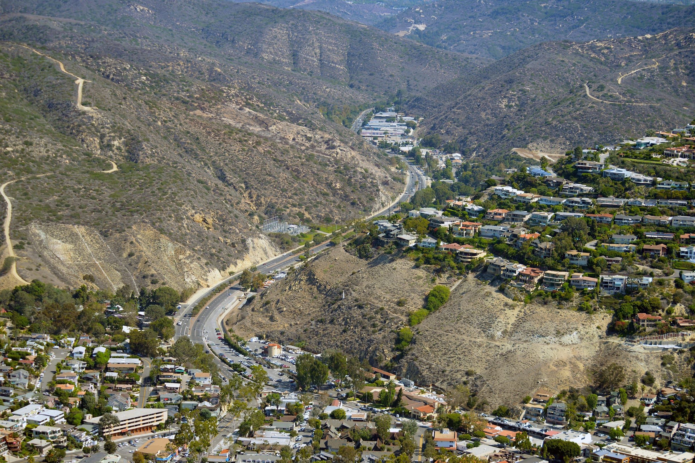
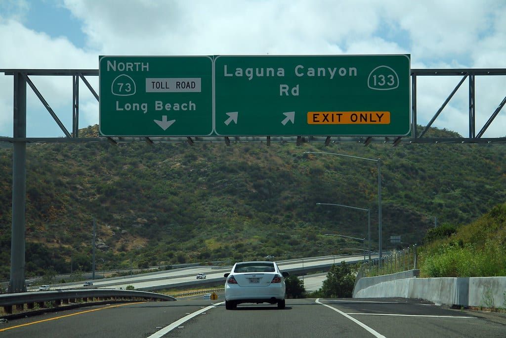
Laguna Beach has two ways in by state highway. Caltrans describes State Route 133, Laguna Canyon Road, as one of two state highways that connect the city to the rest of Orange County. The other is State Route 1, Pacific Coast Highway. Visit Laguna Beach names the 405 as the closest freeway, Highway 133 as the exit and Toll Road 73 as the closest toll road. Caltrans notes that the northern part of SR-133 is a toll road that lets drivers reach Irvine.
The Census Bureau puts mean travel time to work at 29.0 minutes for 2020 to 2024. This page gives no single drive time, because the hour of day and the route change it. Test your own route at the time you would leave.
Distances by road
These are approximate driving distances from Ocean Avenue by Main Beach, measured with OSRM routing on OpenStreetMap data. They are not official figures.
| Destination | Distance by road |
|---|---|
| Fashion Island, Newport Beach | About 7.9 miles |
| Irvine Spectrum | About 9.8 miles |
| John Wayne Airport | About 15.0 miles |
| South Coast Plaza | About 15.8 miles |
| Disneyland | About 24.8 miles |
| Downtown Los Angeles | About 50.5 miles |
Buses and trolleys
Two OCTA routes, Route 1 and Route 89, list stops in Laguna Beach in schedules effective August 9, 2026. OCTA’s blog describes the bus depot on Broadway as the place to connect to OCTA buses that continue to other cities.
- Route 1 runs from Long Beach to San Clemente along Pacific Coast Highway.
- Route 89 runs between Laguna Beach and Rancho Santa Margarita along Laguna Canyon Road, El Toro Road and Santa Margarita Parkway, with a stop at the Laguna Hills Transportation Center.
OCTA’s fact sheet counts four bus routes and 72 bus stops in the city as of June 30, 2026, and more than 130,800 bus boardings in fiscal year 2025-26. Check octa.net for routes beyond these two.
The city runs its own free service. The Coastal Route trolley follows Coast Highway from North Laguna to Dana Point, the Canyon Route and Summer Breeze cover Laguna Canyon Road, and the free on-demand Laguna Local picks up in residential neighborhoods. Transit dispatch is (949) 497-0766. Seasonal hours change, so read the city’s trolley page. See getting around and parking.
John Wayne Airport and trains
Of the four airports on the facts page, John Wayne Airport is the closest by road, about 15 miles. Check OCTA’s schedules for bus connections.
Metrolink stations nearest by road, measured from Main Beach with OSRM routing:
- Laguna Niguel/Mission Viejo, 28200 Forbes Road, Laguna Niguel: about 10.6 miles.
- Irvine, 15215 Barranca Parkway: about 10.8 miles.
- San Juan Capistrano, 26701 Verdugo Street: about 13.6 miles.
Largest employers
The city’s Annual Comprehensive Financial Report for the year ended June 30, 2025 lists its principal employers for 2024-25, based on direct correspondence with local businesses. The table follows the report’s order and names. Its percent of total employment uses a city labor force the report puts at 11,800, from state labor force data.
| Rank | Employer | Employees | Percent of total employment |
|---|---|---|---|
| 1 | Montage Laguna Beach Hotel | 621 | 5.26% |
| 2 | Laguna Beach School District | 365 | 3.09% |
| 3 | Providence Mission Hospital, Laguna Beach (Laguna Beach campus only) | 340 | 2.88% |
| 4 | City of Laguna Beach | 331 | 2.81% |
| 5 | Surf & Sand Resort | 248 | 2.10% |
| 6 | Laguna College of Art & Design | 224 | 1.90% |
| 7 | Las Brisas Restaurant | 162 | 1.37% |
| 8 | Anneliese Schools | 114 | 0.97% |
| 9 | Pavilions | 94 | 0.80% |
| 10 | Mozambique Restaurant | 87 | 0.74% |
The ten together employ 2,586 people, or 21.92 percent of the labor force. The same report lists a fiscal year 2025 unemployment rate of 3.1 percent, taken from state labor data. The city’s website has a Job Openings page for its own positions. See laguna beach facts for more basics.
Questions
How long is the average commute in Laguna Beach?
The Census Bureau's 2020 to 2024 estimate for mean travel time to work is 29.0 minutes. That is an average across all workers and modes, not a drive time for one route.
How far is Laguna Beach from John Wayne Airport?
It is about 15 miles by road from Ocean Avenue by Main Beach, measured with OSRM routing on OpenStreetMap data. Drive time depends on the hour and the route.
Which OCTA buses serve Laguna Beach?
OCTA publishes Route 1, along Pacific Coast Highway, and Route 89, along Laguna Canyon Road and El Toro Road, both with stops at Laguna Beach. OCTA's fact sheet counts four bus routes and 72 stops in the city as of June 30, 2026, so check octa.net for the full list.
What are the biggest employers in Laguna Beach?
The city's financial report for the year ended June 30, 2025 lists the Montage Laguna Beach Hotel first with 621 employees, then the Laguna Beach School District with 365 and Providence Mission Hospital's Laguna Beach campus with 340.
Where is the nearest Metrolink station to Laguna Beach?
Of the stations checked, the Laguna Niguel/Mission Viejo station at 28200 Forbes Road is nearest by road, about 10.6 miles from Main Beach by OSRM routing. The Irvine station is about 10.8 miles and the San Juan Capistrano station about 13.6 miles.
Get the moving checklist
The printable checklist by email: before you move, moving week and your first 30 days.
Living here
More for your move
-
-
-
- Older residents Living here
-
-


Last reviewed
Sources (23)
- Census Bureau QuickFacts: mean travel time to work 29.0 minutes for workers age 16 and over, 2020-2024: census.gov, checked 2026-10-28
- Caltrans environmental document: SR-133 is one of two state highways that connect Laguna Beach to the rest of Orange County, the other being SR-1, Pacific Coast Highway; the northern portion of SR-133 also functions as a toll road that lets commuters reach the City of Irvine: files.ceqanet.lci.ca.gov, checked 2026-10-28
- Visit Laguna Beach: closest freeway is the 405, closest exit Highway 133, closest toll road Toll Road 73; Highway 133 South becomes Laguna Canyon Road and then Broadway: visitlagunabeach.com, checked 2026-10-28
- Driving distance from Ocean Avenue by Main Beach to Fashion Island, about 7.9 miles (OSRM route on OpenStreetMap data; not an official distance): router.project-osrm.org, checked 2026-10-28
- Driving distance from Ocean Avenue by Main Beach to Irvine Spectrum, about 9.8 miles (OSRM route on OpenStreetMap data; not an official distance): router.project-osrm.org, checked 2026-10-28
- Driving distance from Ocean Avenue by Main Beach to John Wayne Airport, about 15.0 miles (OSRM route on OpenStreetMap data; not an official distance): router.project-osrm.org, checked 2026-10-28
- Driving distance from Ocean Avenue by Main Beach to South Coast Plaza, about 15.8 miles (OSRM route on OpenStreetMap data; not an official distance): router.project-osrm.org, checked 2026-10-28
- Driving distance from Ocean Avenue by Main Beach to Disneyland, about 24.8 miles (OSRM route on OpenStreetMap data; not an official distance): router.project-osrm.org, checked 2026-10-28
- Driving distance from Ocean Avenue by Main Beach to downtown Los Angeles, about 50.5 miles (OSRM route on OpenStreetMap data; not an official distance): router.project-osrm.org, checked 2026-10-28
- Driving distance from Ocean Avenue by Main Beach to the Laguna Niguel/Mission Viejo Metrolink station, about 10.6 miles (OSRM route on OpenStreetMap data; not an official distance): router.project-osrm.org, checked 2026-10-28
- Driving distance from Ocean Avenue by Main Beach to the Irvine Metrolink station, about 10.8 miles (OSRM route on OpenStreetMap data; not an official distance): router.project-osrm.org, checked 2026-10-28
- Driving distance from Ocean Avenue by Main Beach to the San Juan Capistrano Metrolink station, about 13.6 miles (OSRM route on OpenStreetMap data; not an official distance): router.project-osrm.org, checked 2026-10-28
- OCTA Route 1: Long Beach to San Clemente via Pacific Coast Highway; schedules effective August 9, 2026: octa.net, checked 2026-10-28
- OCTA Route 89: Laguna Beach to Rancho Santa Margarita via Laguna Canyon Road, El Toro Road and Santa Margarita Parkway, with a stop at the Laguna Hills Transportation Center; Monday-Friday and Saturday, Sunday and holiday schedules effective August 9, 2026: octa.net, checked 2026-10-28
- OCTA blog, October 12, 2023: the bus depot on Broadway Street lets riders connect with OCTA buses that continue to other cities: blog.octa.net, checked 2026-10-28
- City of Laguna Beach website navigation lists Job Openings under Apply For: lagunabeachcity.net, checked 2026-10-28
- OCTA Laguna Beach fact sheet as of June 30, 2026: 4 bus routes serving 72 bus stops in Laguna Beach; more than 130,800 bus boardings in FY 2025-26; Laguna Local service on Laguna Canyon Road and El Toro Road; Summer Breeze bus service: octa.net, checked 2026-10-28
- City trolleys: free Coastal Route on Coast Highway between North Laguna and Dana Point; Canyon Route from the Act V lot; Summer Breeze from a free lot in Irvine; free on-demand Laguna Local; Transit Division/Dispatch (949) 497-0766: lagunabeachcity.net, checked 2026-10-28
- Metrolink Laguna Niguel/Mission Viejo station at 28200 Forbes Rd., Laguna Niguel, CA 92677, on the Orange County and Inland Empire-Orange County lines: metrolinktrains.com, checked 2026-10-28
- Metrolink Irvine station at 15215 Barranca Parkway, Irvine, CA 92618: metrolinktrains.com, checked 2026-10-28
- Metrolink San Juan Capistrano station at 26701 Verdugo St., San Juan Capistrano, CA 92675: metrolinktrains.com, checked 2026-10-28
- City of Laguna Beach Annual Comprehensive Financial Report, year ended June 30, 2025, page 172, Principal Employers, 2024-25 column, in this order: Montage Laguna Beach Hotel 621 employees (5.26 percent), Laguna Beach School District 365 (3.09), Providence Mission Hospital, Laguna Beach* 340 (2.88; * Laguna Beach campus only), City of Laguna Beach 331 (2.81), Surf & Sand Resort 248 (2.10), Laguna College of Art & Design 224 (1.90), Las Brisas Restaurant 162 (1.37), Anneliese Schools 114 (0.97), Pavilions 94 (0.80), Mozambique Restaurant 87 (0.74); top 10 total 2,586 (21.92 percent); total city labor force 11,800 from EDD labor force data; source MuniServices/Neumo; results based on direct correspondence with local businesses: ocauditor.gov, checked 2026-10-28
- Annual Comprehensive Financial Report, page 171: unemployment rate 3.1 percent for fiscal year 2025, from the EDD's Bureau of Labor Statistics data: ocauditor.gov, checked 2026-10-28