
- Emergency
- 911
- City text alerts
- Text 92651 to 888-777
- Evacuation zones
- 22, listed LAB01 to LAB22
- Red Flag parking alerts
- Text LBREDFLAG to 888-777
- Fire non-emergency
- (949) 497-0700
Sign up for alerts
The city’s Alert and Warning page says some of its systems need a sign-up and others reach everyone in an area.
- City text alerts. Text 92651 to 888-777. This covers citywide emergency alerts and the Community Newsletter. The city also lists separate texts for traffic (LBTRAFFIC), business notices (LBBIZ), dog park closures (LBDOGPARK) and Red Flag parking (LBREDFLAG), all to 888-777. The same alerts run in the Nixle Everbridge app.
- AlertOC. This is Orange County’s regional notification system. The city says it can target a single area or neighborhood, and it asks residents to register at AlertOC.com.
- Wireless Emergency Alerts. No registration. They use the same technology as Amber Alerts, reach phones in the affected area and reach visitors too.
- Outdoor warning sirens and speakers. The city installed them with Genasys. It tests them every quarter at 4:00 PM and announces each test ahead of time. As of October 2026, its Alert and Warning page lists the next test for Wednesday, December 2, 2026, moved from December 15. Dates can change.
The county’s Emergency Alert System can only target all of Orange County, not Laguna Beach alone, according to the city.
Power shutoff alerts
The city’s Public Safety Power Shutoffs page says Southern California Edison and San Diego Gas & Electric may both shut off power in parts of Laguna Beach during dangerous fire weather. Each utility sends its own alerts:
- SCE. Customers choose email, text or voice alerts in the Preference Center of their SCE account. SCE also offers PSPS address alerts for people without their own account, such as tenants and caregivers.
- SDG&E. It says direct alerts start 24 to 48 hours before a shutoff and go by phone, text or email to the contact details in My Energy Center. Its Alerts by SDGE app tracks up to five addresses and needs no account number.
Find your evacuation zone
The city’s Evacuation Planning page lists 22 evacuation management zones: LAB01 Arch Beach Heights, LAB02 Balboa Nyes, LAB03 Big Bend, LAB04 Bluebird Canyon, LAB05 Boat Canyon, LAB06 Canyon Acres, LAB07 Ceanothus, LAB08 El Toro, LAB09 North Coast, LAB10 Downtown, LAB11 Sun Valley, LAB12 Emerald Bay, LAB13 Irvine Cove, LAB14 Mar Vista, LAB15 Old Top of the World, LAB16 Park Avenue, LAB17 Sunset, LAB18 Temple Hills, LAB19 Top of the World, LAB20 Wesley, LAB21 Central Coast and LAB22 South Coast.
Each zone has its own evacuation map on that page, and a citywide map shows all 22. The city recommends you download and print the map for your zone and learn your routes.
The city’s public GIS map shows a different breakdown. Its evacuation zone layer stops at LAB20 and splits the coast into LAB09a (North Coast), LAB09b (Central Coast) and LAB09c (South Coast). It has no Sun Valley zone, and it labels LAB08 Club Laguna and LAB11 El Toro. Search your address on the GIS map, then confirm your zone on the citywide map on the Evacuation Planning page, because the two use different names and numbers in places.
Order and warning
The city’s Evacuation Planning page defines two terms.
- Evacuation Order: an imminent threat to life and property. The city says people and pets in the area should leave now, and that anyone who stays cannot expect rescue once the incident is under way.
- Evacuation Warning: a potential threat. The city says to prepare to leave, and that people with access or functional needs and people with large animals should go now. If you feel threatened at any point, the city says to leave without waiting for an official notice.
Get ready to leave
The city’s Prepare for Emergencies page lists these steps:
- Know your evacuation zone and at least two routes out of your neighborhood.
- Assemble an emergency kit. The city says you may have to rely on it for at least a week, so include pet supplies and anything your household needs. It has videos on building a go-kit, on alerts and on evacuations.
- Write a household plan: how people contact each other and where you meet.
- Make an evacuation list of what to grab, and keep key phone numbers on paper.
- Get to know your neighbors and what help they might need.
For a Public Safety Power Shutoff, the city also asks you to keep your gas tank at least half full, or your electric vehicle charged enough to evacuate. Southern California Edison posts shutoff information at sce.com/psps and takes calls at 1-800-611-1911.
Red Flag Warning days and parking
A Red Flag Warning is a National Weather Service product. The city’s page says one is issued when low humidity, strong winds or dry lightning meet set thresholds, and that Laguna Beach averages about one warning day a year.
On those days, parking restrictions apply on named streets in Bluebird Canyon, Canyon Acres and Diamond/Crestview. The city says its 2021 Wildfire Egress Study identified those neighborhoods as “access impaired” because of narrow, winding roads. Where it can, the city limits parking to one side of the street. It posts the status at the top of its Red Flag Parking page, opens signs, texts the LBREDFLAG group and posts on social media. Parking and permits covers the citation rules.
Brush clearance and defensible space
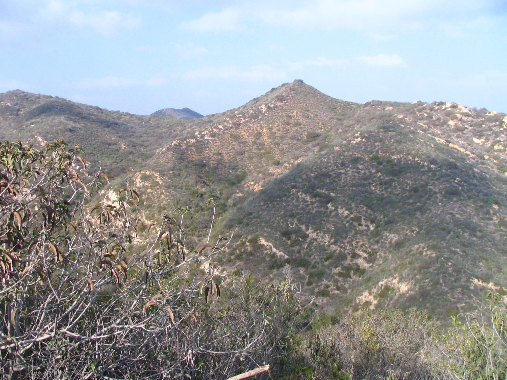
The Laguna Beach Fire Department runs the city’s vegetation rules. Its Wildfire Mitigation page says 87 percent of the city’s land area, and about 65 percent of its buildable property, falls in the Very High Fire Hazard Severity Zone as CAL FIRE designates it. The city adopted 2025 maps and offers an address lookup for the Moderate, High and Very High levels.
The department describes four programs:
- Defensible space. State law requires it around structures in the Very High zone. It runs from the building out to 100 feet or the property line: 0 to 5 feet, 5 to 30 feet and 30 to 100 feet, with more work closer to the house. Ordinance 1664 made the city’s guideline apply to existing structures on November 5, 2021.
- Fuel modification for development. New construction and major remodels in the city’s FM Zone follow the 2019 standards, and the city says homes built under these standards must be kept in their approved fuel-modified state permanently.
- Weed abatement. The department runs it every spring in the developed part of town under Ordinance 1510.
- Fuel breaks. About 363 acres, of which roughly 276 are grazed by goats and the rest cleared by hand crews.
The department’s Goat Grazing Program page says the city has used goats to reduce wildfire fuel since the early 1990s and expanded the program after the 1993 fire. The goats graze 10 fuel modification zones on the city’s edge, usually when vegetation is dry, and the city uses between 75 and 600 goats a year. Botanists flag and fence off sensitive plants before grazing starts. The department says the fuel break program is expanding to South Laguna, Park Avenue and lower Bluebird Canyon.
If you see overgrown, dry vegetation, you can report it through the city’s AskLaguna tool or app. If you are selling a home of one to four units in the Very High zone, the fire department performs the AB 38 defensible-space inspection and, once the property meets the requirements, issues a Letter of Compliance. The city says fire prevention staff respond to a request within one to two business days.
The department also does a free in-home Wildfire Consultation for property owners. For the structure itself, its Home Hardening page covers roofs, gutters, vents, eaves, siding, windows and decks.
Community programs
The city’s CERT Academy is free, about 25 hours of classes and a final drill, for anyone 13 or older who lives, works or attends school in Laguna Beach. You must attend every session. Graduates can apply to join the city’s Community Emergency Response Team after a background check and more training. Call the Community Preparedness Educator at (949) 715-8615. The volunteering page lists CERT with other ways to help in town.
Neighborhoods of at least eight homes can apply to become a Firewise USA community with help from the Fire Prevention Division at (949) 497-0726. The city’s Firewise page lists the recognized ones.
Phone numbers
- Emergency: 911
- Fire Department non-emergency: (949) 497-0700
- Emergency Management Administrator: (949) 497-0350
- City Hall: (949) 497-3311
For hospitals and poison control, see hospitals and urgent care.
Questions
How do you sign up for Laguna Beach emergency alerts?
Text 92651 to 888-777 for the city's citywide alerts and Community Newsletters. The city also asks residents to register for AlertOC, the Orange County regional system, and says Wireless Emergency Alerts need no sign-up.
How do you find your evacuation zone in Laguna Beach?
The city's Evacuation Planning page lists 22 evacuation management zones, LAB01 to LAB22, with a map for each and a citywide map. The city's public GIS map labels the zones differently, so search your address there and then confirm your zone on the citywide map on the Evacuation Planning page. The city recommends you download and print the map for your zone.
What is a Red Flag Warning, and what does it change for parking?
It is a National Weather Service warning issued when low humidity, strong winds or dry lightning raise the fire risk. When it is issued, the city restricts parking on named streets in Bluebird Canyon, Canyon Acres and Diamond/Crestview and posts the status on its Red Flag Parking page.
How far from your house does defensible space extend?
The city says defensible space runs from the edge of the structure out to 100 feet or the property line, whichever is closer, in three zones that start at 0 to 5 feet.
Can you get a free wildfire consultation in Laguna Beach?
Yes. The Laguna Beach Fire Department offers a free consultation to property owners in the city. Staff visit and advise on preparing the structure and landscape.
Get the moving checklist
The printable checklist by email: before you move, moving week and your first 30 days.
Living here
More for your move
-
-
-
- Hospital and urgent care Living here
-
-

Last reviewed
Sources (26)
- Some systems need a sign-up and others reach everyone in an area; text 92651 to 888-777 for citywide emergency alerts and Community Newsletters; LBTRAFFIC, LBBIZ, LBDOGPARK and LBREDFLAG texts; Nixle Everbridge app; AlertOC is Orange County's geo-targeted regional notification system, register for AlertOC; Wireless Emergency Alerts use the same technology as Amber Alerts, need no registration and reach visitors; Outdoor Warning System of speakers and sirens installed with Genasys Inc.; quarterly tests at 4:00 PM announced in advance; the December 15, 2026 test was rescheduled to Wednesday, December 2, 2026; dates subject to change; County Emergency Alert System can only target the whole county: lagunabeachcity.net, checked 2026-10-28
- Same text-alert sign-up codes and the Nixle registration link; City Hall phone 949-497-3311: lagunabeachcity.net, checked 2026-10-28
- 22 Evacuation Management Zones: LAB01 Arch Beach Heights, LAB02 Balboa Nyes, LAB03 Big Bend, LAB04 Bluebird Canyon, LAB05 Boat Canyon, LAB06 Canyon Acres, LAB07 Ceanothus, LAB08 El Toro, LAB09 North Coast, LAB10 Downtown, LAB11 Sun Valley, LAB12 Emerald Bay, LAB13 Irvine Cove, LAB14 Mar Vista, LAB15 Old Top of the World, LAB16 Park Avenue, LAB17 Sunset, LAB18 Temple Hills, LAB19 Top of the World, LAB20 Wesley, LAB21 Central Coast, LAB22 South Coast; a map for each zone plus a citywide Neighborhood Zone Areas map labeled LAB01 to LAB22; the city recommends you download and print yours (read via Wayback capture of October 2, 2026, the latest); definitions of Evacuation Order (mandatory, imminent threat, no forced removal, no rescue promised) and Evacuation Warning (potential threat; people with access and functional needs and large animals should leave now; personal discretion allowed but not advised; do not wait for official notice if you feel threatened): lagunabeachcity.net, checked 2026-10-28
- The city's public GIS viewer (linked from City Maps and GIS) has an Evacuation Zone layer with a different breakdown: LAB01 to LAB20 with the coast split into LAB09a North Coast, LAB09b Central Coast and LAB09c South Coast; no Sun Valley zone; LAB08 Club Laguna and LAB11 El Toro; searchable by address: gis.lagunabeachcity.net, checked 2026-10-28
- City Maps and GIS opens the public GIS viewer at gis.lagunabeachcity.net/Html5Viewer/index.html?viewer=LagunaBeachPublicGIS: lagunabeachcity.net, checked 2026-10-28
- Prepare for Emergencies: Emergency Preparedness Guide; know your evacuation zone and at least two routes out of your neighborhood; kit that may need to last at least a week, with pet supplies; household emergency plan; evacuation list; keep important numbers written down; check on neighbors; city says the majority of Laguna Beach is within the Very High Fire Severity Zone; videos on building a go-kit, alerts, evacuations and home hardening: lagunabeachcity.net, checked 2026-10-28
- Public Safety Power Shutoffs: SCE and SDG&E may use them in Laguna Beach; SCE sce.com/psps and 1-800-611-1911; keep the gas tank at least half full or the EV charged enough to evacuate; sign up for Nixle (text 92651 to 888777) and AlertOC: lagunabeachcity.net, checked 2026-10-28
- Emergency Management Administrator (949) 497-0350: lagunabeachcity.net, checked 2026-10-28
- CERT Academy: about 25 hours of classroom and hands-on training with a final drill, free, ages 13 and up who live, work or attend school in Laguna Beach, must attend all sessions; graduates may join the CERT program after a background check and additional training; Community Preparedness Educator (949) 715-8615: lagunabeachcity.net, checked 2026-10-28
- Red Flag parking restrictions when the National Weather Service issues a Red Flag Warning for Bluebird Canyon, Canyon Acres and Diamond/Crestview, neighborhoods the 2021 Wildfire Egress Study identified as access impaired; one side of the road where feasible; city updates its website, opens signs, texts the Red Flag group (LBREDFLAG to 888777) and posts to social media; Red Flag Warning criteria (low relative humidity with strong sustained winds or gusts, very low humidity alone, or widespread or dry lightning); warnings average about one day a year; the page's top line says whether restrictions are in effect: lagunabeachcity.net, checked 2026-10-28
- Fire department Wildfire Mitigation page: 87% of land area and about 65% of buildable property in the Very High Fire Hazard Severity Zone as CAL FIRE designates it; four vegetation programs (weed abatement, fuel modification for development, defensible space, fuel breaks); weed abatement annually in the spring in the developed portion; homes built under the fuel modification standards must be maintained in the approved state in perpetuity; free wildfire consultation for all property owners: lagunabeachcity.net, checked 2026-10-28
- Defensible space: state law requires it around structures in the Very High zone; zones 0 to 5, 5 to 30 and 30 to 100 feet (or the property line); Ordinance 1664 adopted October 5, 2021, compliance effective November 5, 2021 for existing structures; home risk assessment form and ember checklist: lagunabeachcity.net, checked 2026-10-28
- AB 38 defensible-space inspection for sales of one-to-four-unit homes in the Very High zone, conducted by the fire department; Letter of Compliance once the property is verified as meeting the requirements; a fire prevention staff member responds to a request within 1 to 2 business days; City Council adopted the 2025 Fire Hazard Severity Zone maps on June 24, 2025; interactive address lookup: lagunabeachcity.net, checked 2026-10-28
- 2025 Fire Hazard Severity Zone maps for Laguna Beach show Moderate, High and Very High; PDF map and two interactive maps to search an address: lagunabeachcity.net, checked 2026-10-28
- Free Wildfire Consultation: fire department staff visit your home and advise on preparing the structure and landscape: lagunabeachcity.net, checked 2026-10-28
- Weed abatement program in the developed portion of the city, Ordinance 1510 and Municipal Code Section 12.12: lagunabeachcity.net, checked 2026-10-28
- Fuel Modification for Development: new construction and major remodel in the FM Zone follow the 2019 Landscape/Fuel Modification Standards and Maintenance Program; Building Division reviews single-family homes, duplexes and ADUs: lagunabeachcity.net, checked 2026-10-28
- Fuel break program: about 363 acres, about 276 acres maintained by goat grazing and the rest by hand crews; Fire Non-Emergency (949) 497-0700: lagunabeachcity.net, checked 2026-10-28
- Report overgrown, dry vegetation through the AskLaguna tool or app: lagunabeachcity.net, checked 2026-10-28
- Firewise USA neighborhoods: groups of at least 8 homes; Fire Prevention Division (949) 497-0726; the page lists the recognized communities: lagunabeachcity.net, checked 2026-10-28
- Home hardening guidance for roofs, gutters, vents, eaves, siding, windows and decks: lagunabeachcity.net, checked 2026-10-28
- City Public Safety Power Shutoffs page: power companies may proactively turn off power in dangerous weather in fire-prone areas; Southern California Edison (SCE) and San Diego Gas & Electric (SDGE) may implement PSPS in certain areas, including in the City of Laguna Beach; residents stay informed by contacting their power company; sign up for SCE and SDGE outage notifications, Nixle and AlertOC: lagunabeachcity.net, checked 2026-10-28
- SCE Get Power Outage Alerts: SCE customers go to the Preference Center in My Account and choose alerts by email, text or voice call; PSPS address alerts for non-SCE customers, helpful for residential and commercial tenants who do not maintain their own SCE service accounts, caregivers, frequent travelers and service providers: sce.com, checked 2026-10-28
- SDG&E Public Safety Power Shutoffs page: direct alerts start 24 to 48 hours before a shutoff; SDG&E may contact you by phone, text message, email or all of these; update contact information in My Energy Center if you do not receive alerts; the Alerts by SDGE mobile app gives real-time outage updates, tracks up to 5 addresses and needs no account number: sdge.com, checked 2026-10-28
- Goat Grazing Program: goats used for vegetation management and wildfire fuel reduction since the early 1990s; expanded after the 1993 wildfire; focuses on 10 fuel modification zones on the city's perimeter; goats brought in seasonally, typically when vegetation is dry and most flammable; between 75 and 600 goats used annually; botanists assess grazing areas, sensitive plants are flagged and fenced off: lagunabeachcity.net, checked 2026-10-28
- Wildfire Mitigation / Vegetation Management: the Fuel Break Program is currently in process of expansion to South Laguna, Park Avenue and lower Bluebird Canyon; fuel breaks maintained by goat grazing and hand crews: lagunabeachcity.net, checked 2026-10-28